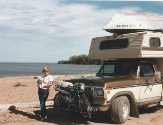
SUMMER OF 1985
FROM NEVADA TO IDAHO, TO BANFF, LAKE LOUISE, JASPER,
AND THE NORTHWEST TERRITORIES IN ALBERTA, CANADA

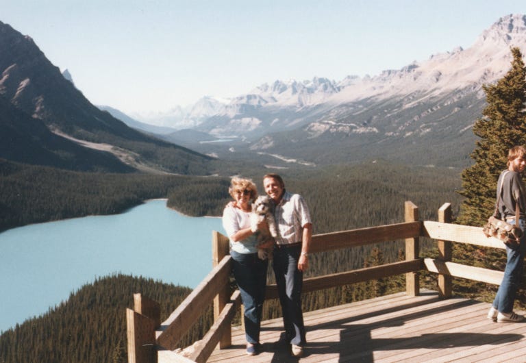
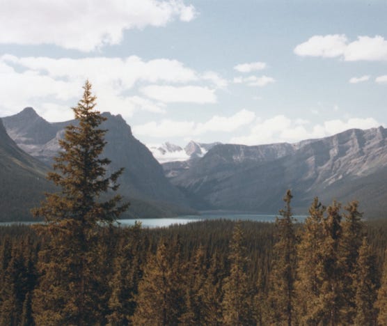
Bill, Nancy, And Me Looking Down On Peyto Lake In Banff National Park In Alberta, Canada. We Are On the Bow Summit Lookout Along The Columbia Icefield Parkway.
Well, the last time you left us we just finished our trip to the Inside Passage, fishing for salmon on Vancouver Island. We spent the winter at Desert Shores in California doing all of our favorite things and decided that we should plan a trip to see the sites in Alberta, Canada.
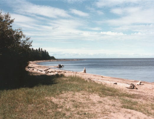
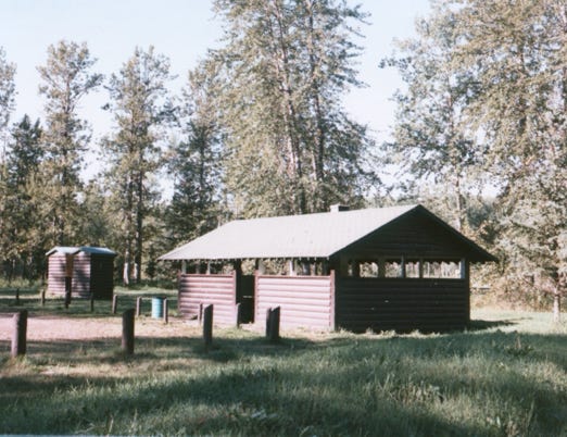
We left in mid-June traveled up north to Nevada, and stopped at Walker Lake Recreation Area for several days. Walker Lake is a natural lake, in the Great Basin in western Nevada. It is 12 miles long and 5 miles wide and managed by the BLM. We stayed at the Sportsman’s Beach Campground. With the declining water levels and the increase in salinity, fishing for the famous Lahontan Cutthroat Trout is no longer available.
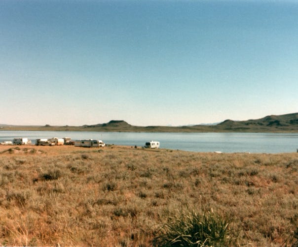
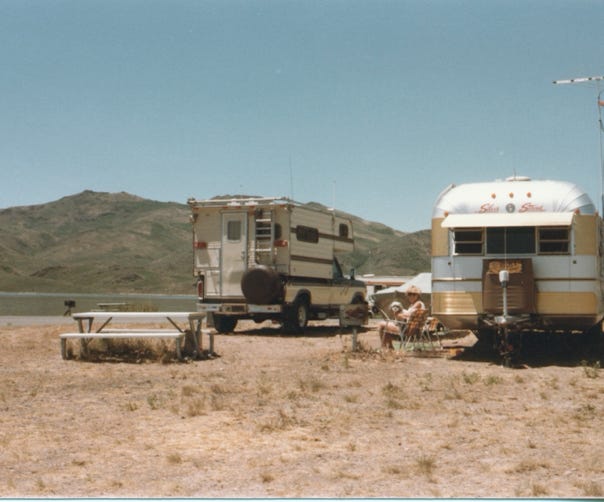
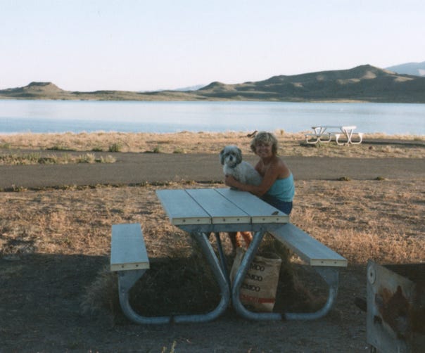
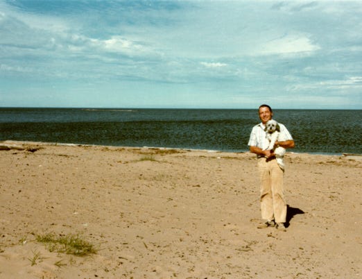
We then went to fish Wild Horse Reservoir, North of Elko, Nevada. They have an established State Recreation Area that has 34 camping sites without hookups, but they have water and a dump station.
We camped on the northeast side of the reservoir that is managed by the Shoshone-Paiute Tribes. You can stay for a few days to a month dry camping along the shoreline of the reservoir. We spent several weeks there fishing for German brown trout, smallmouth bass, rainbow trout, and other types of fish.
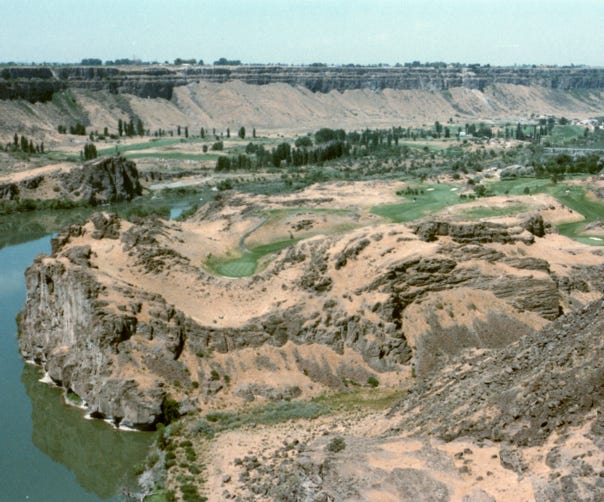
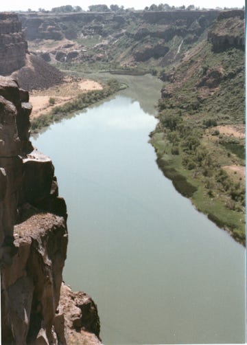
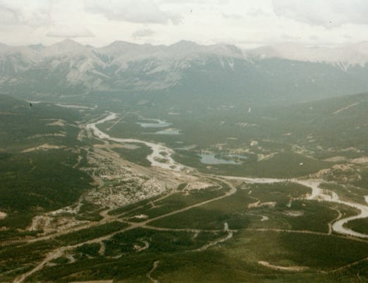
We then drove to the Snake River in Idaho, you can see the Snake River and a beautiful golf course along the banks of the Snake River.
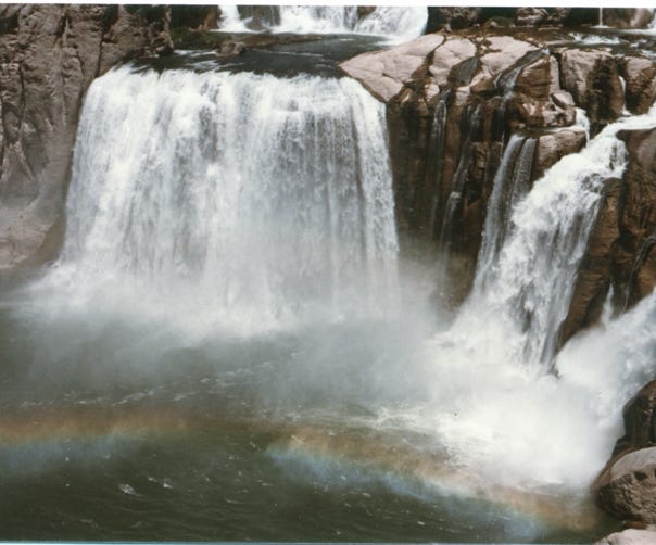
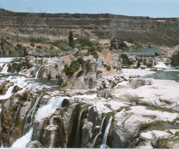
We then drove to Shoshone Falls out of Twin Falls, Idaho. Often called “The Niagara Of The West.” The falls are 212 feet tall and 900 feet wide.
The Shoshone Falls is one of the largest natural waterfalls in the United States surpassing the height of the famous Niagara Falls as it winds down the basalt canyon on its way to the Columbia River.
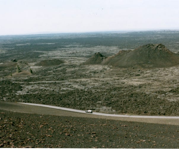
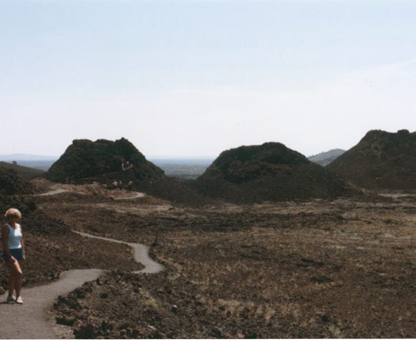
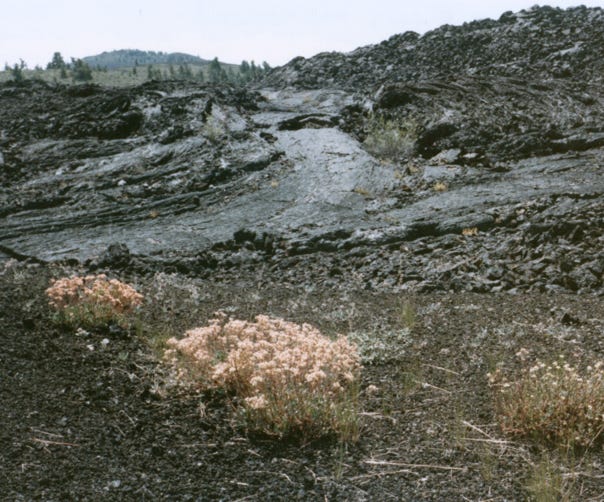
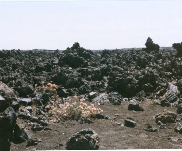
Then, it was off to see “Craters Of The Moon” a vast area of eight major lava eruptions that occurred between 15,000 and 2,000 years ago. This area covers over 618 square miles, and even today it is experiencing stretching from earthquake activity.
A view from the inferno cone of Big Cinder Butte Towers above the lava plains in the distance. One of the largest purely basaltic cinder cones in the world.
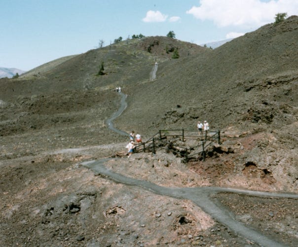
Three Spatter Cones, the material and forces of these eruptions originated at a depth of nearly 37 miles within the earth.
Big Craters, is a snow cone where snow lies in the bottom all year long.
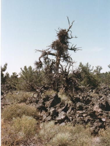
We walked the trail to Devil’s Orchard - Witches Broom. You can see large old Limber Pine trees were malformed in Devil Orchard by a small parasitic plant known as Dwarf Mistletoe. It attaches to the pine and takes on water and nutrients from the pine, the pine weakens but does not die. This creates small masses on the pine and is called “Witches Broom.”
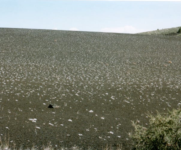
Walking along many trails of bare earth, you will see Dwarf Buckwheat plants dot the large plains of black cinder creating a mosaic look.
Basalt Lava flows are grouped by appearance. This photo is Pahoe Hoe (Pa-Hoy-Hoy) which means “Ropy or Friendly by the Hawaiian terms.” This is smoother and hardens like pleats or rope.
This is Aa (Ah-Ah) which means “Hard on the feet and Unfriendly.” Aa cuts hands and boots were more viscous on emerging and usually formed shorter flows than Pahoe Hoe.
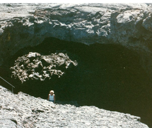
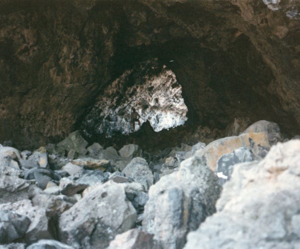
Here, you will see Nancy in the Indian Cave, this is the largest lava tube over 30 feet tall and 50 feet wide, and over 800 feet in length. You can barely see Bill in the background of the Indian Cave Tunnel.
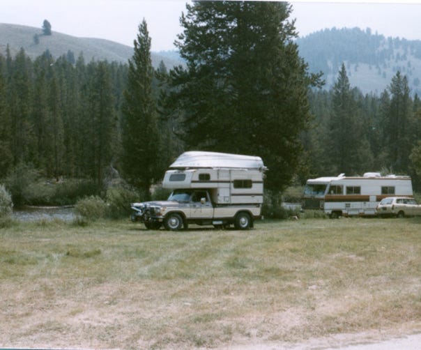
Camping along the Salmon River in
Stanley, Idaho.
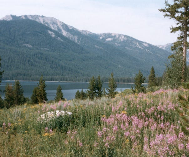
Wildflowers at Alturas Lake in Stanley.
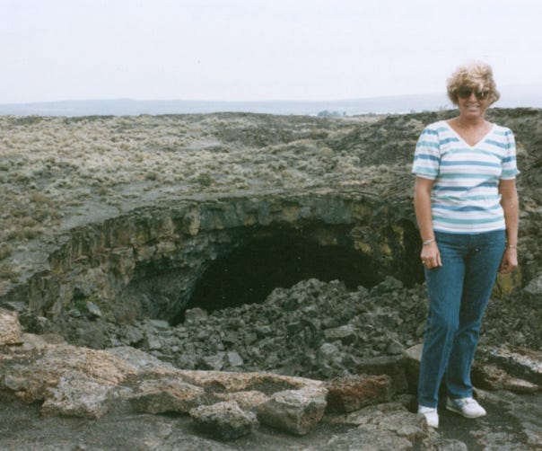
Then, we are off to explore Shoshone Ice Caves. Nancy is standing at the entrance of an ice cave. These are unusual caves of ice that maintain a temperature of 28 to 30 degrees while a few feet away on the surface the thermometer may read over 100 degrees.
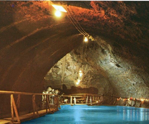
This is a postcard of inside the cave, a first-room view of one of the largest ice caves, the ice block is over 1,000 feet long and varies from 8 to 30 feet.
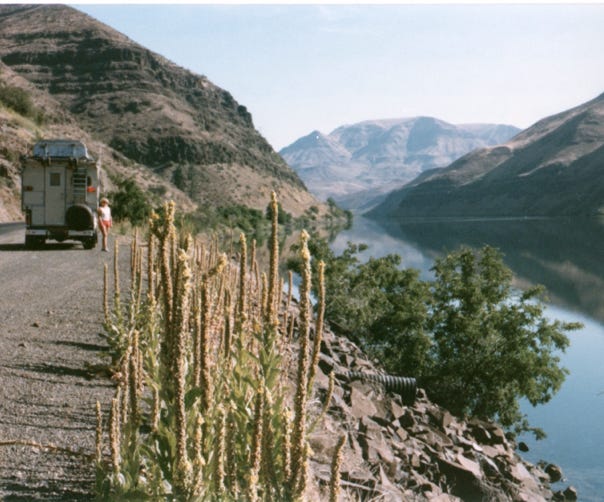
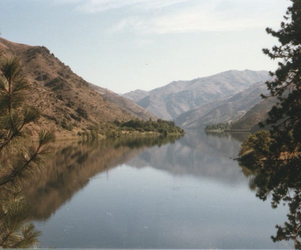
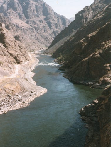
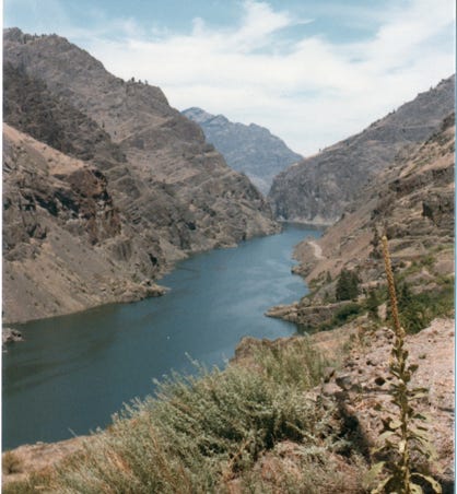
Driving along the 50-mile route to Hells Canyon Dam and the Snake River below Brownlee Dam. The next photo is of the Snake River below Oxbow Dam.
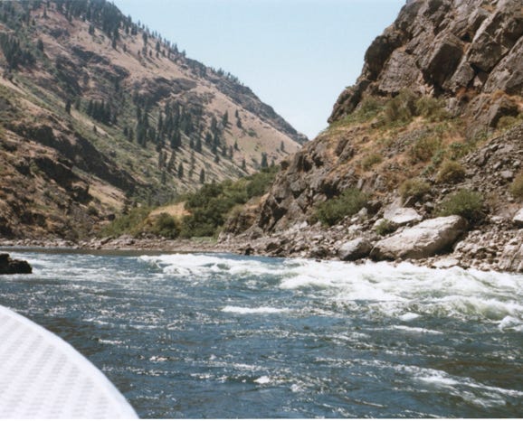
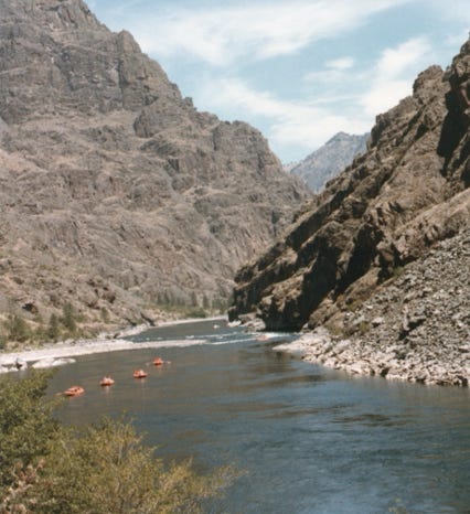
A view of the Snake River below Hells Canyon Dam. This is the deepest and most rugged canyon in North America, averaging 6,600 feet in depth with surrounding mountain peaks to 10,000 feet. There are 70 miles of whitewater rapids and deep pools along the Snake River.
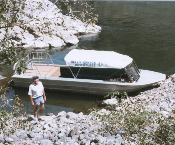
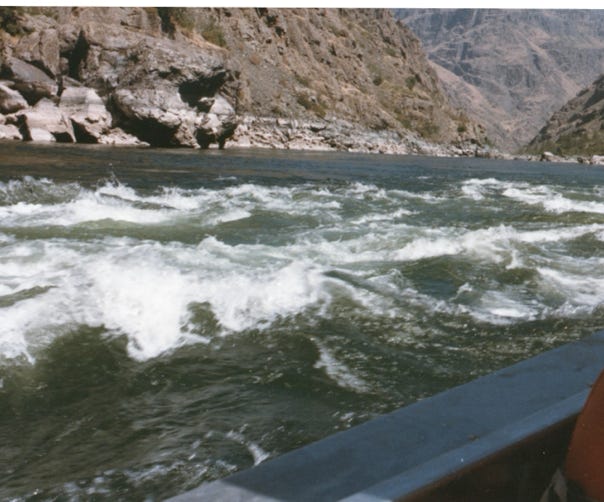
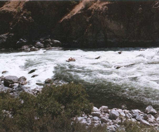
Bill and Nancy decided to take a jet boat trip down the Snake River while I stayed in the camper sleeping, of course. Bill is waiting to board the jet boat. You will see Battle Rapids, and rafters going down Wild Sheep Rapids.
Then, it was our turn to go down these rapids, what a ride!
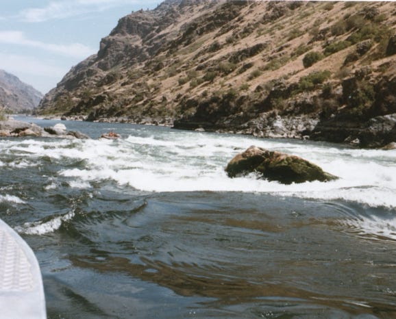
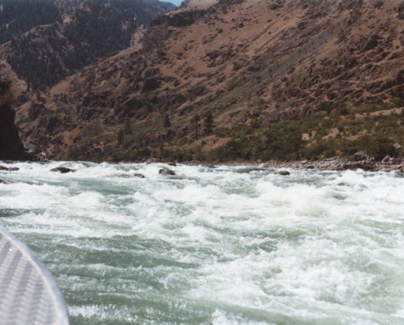
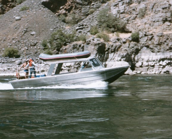
We are in the jet boat going down the Wild Sheep Rapids, this was exciting and fun at the same time.
You will see many different watercraft as this is a popular spot for camping along the shoreline.
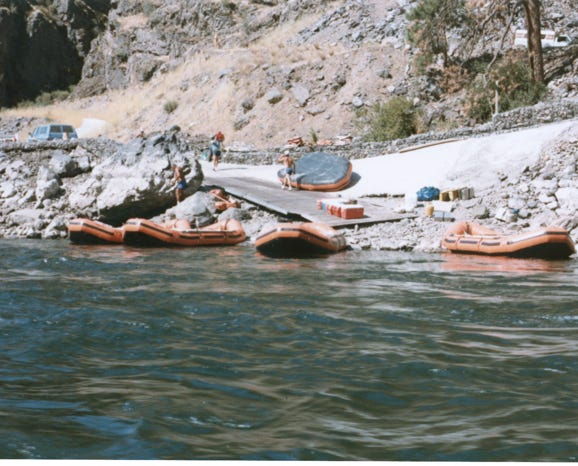
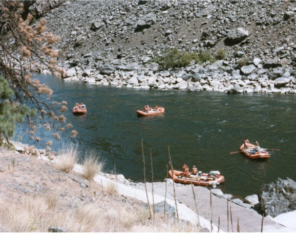
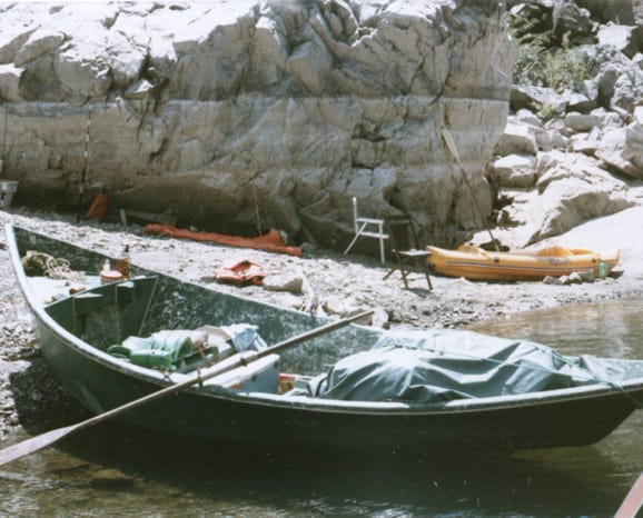
A group of rafters getting ready to float down the Snake River. As people float down the Snake River, they explore and see the sites of the deep-carved mountains and scenery. Many of these trips are day trips to overnight camping along the shoreline.
Another view of the Snake River below Oxbow Dam and Hells Canyon Park.
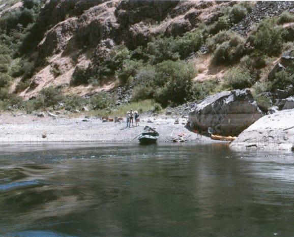
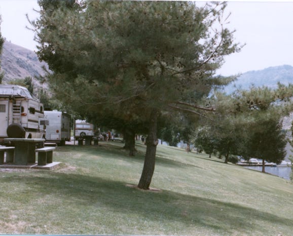
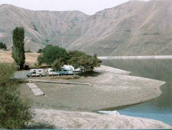
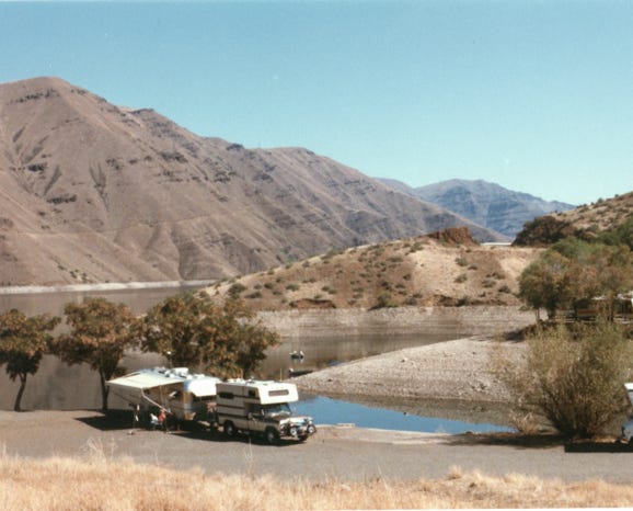
Here, we are camping along the shoreline of Brownlee Reservoir, operated by the Idaho Water and Power Company.
You can see how the water fluctuates and how the docks are high and dry, this was in July.
The camping fee back then was $3.00 a day with electricity, not bad.
This is a 13,000-acre reservoir that stretches over fifty miles. We stayed there for several weeks fishing for Bass, Catfish, Brook Trout, and other species of fish.
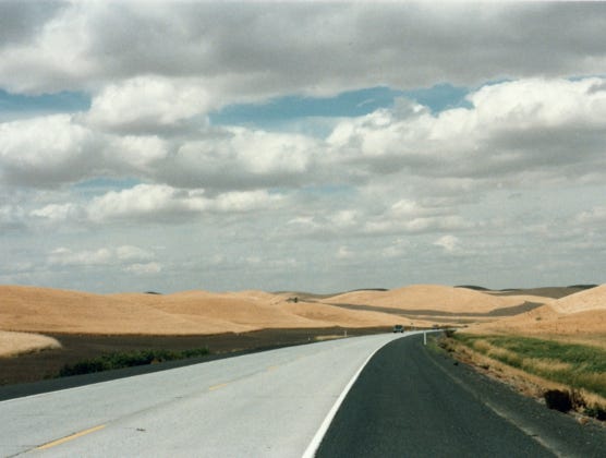
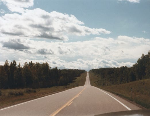
Now, it was time to hook up and head North on Highway 84 going through the State of Washington and the wheat fields of Walla Walla, Washington on Highway 12.
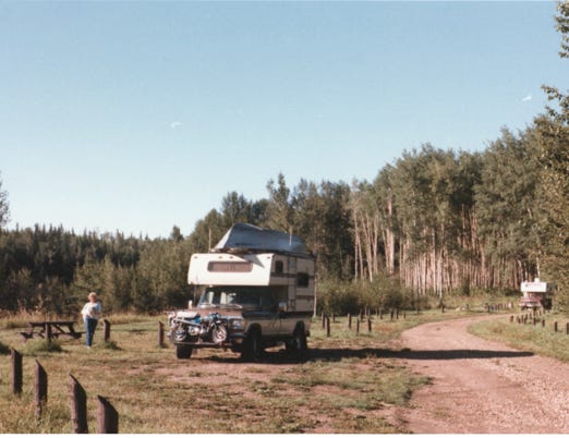
We continued on Highway 95 and planned to leave the trailer at a trailer park in Coeur d’Alene, Idaho, and take the truck and camper for the rest of the trip to explore the Northwest Territories.
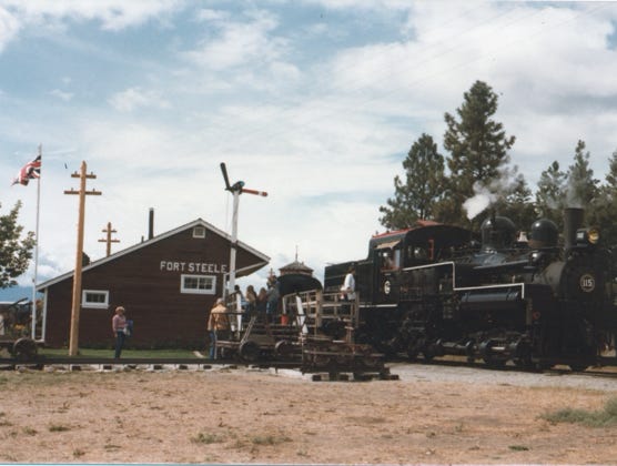
We drove Highway 95 to Creston, British Columbia, and crossed the border on our way to Fort Steele. Here, you will see a steam engine train. Fort Steele was a gold rush boomtown founded in 1864 by John Galbraith.
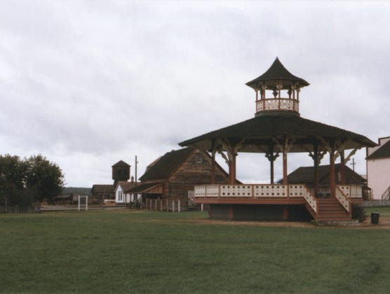
Fort Steele has 40 restored buildings from the 1890 period and was the first northwest mounted police post in British Columbia. You can see the bandstand in the background.
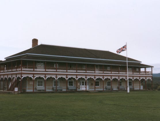
A photo of the tea room and museum, what a beautiful building and well-maintained.
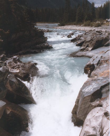
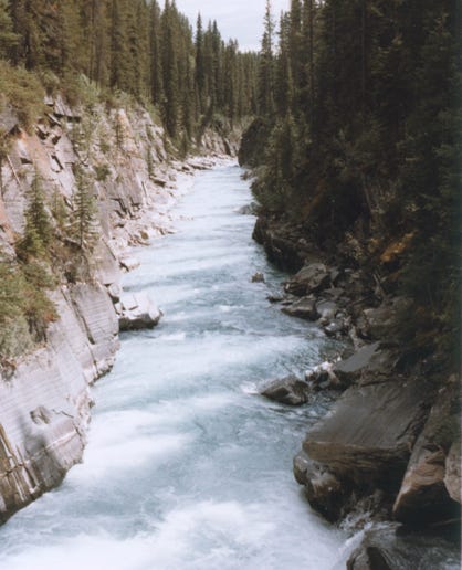
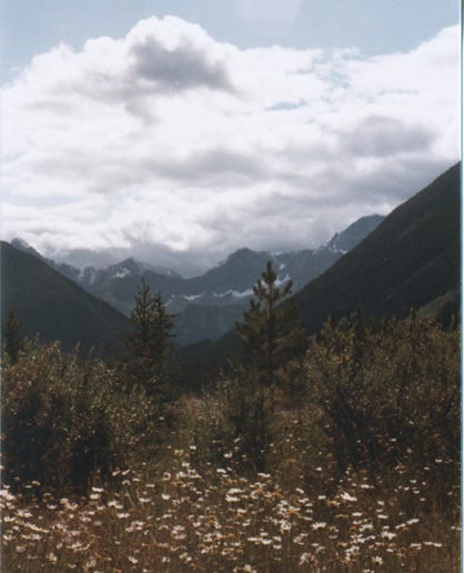
We left Fort Steele and took Highway 93 North exploring all of the sites in Kootenay National Park.
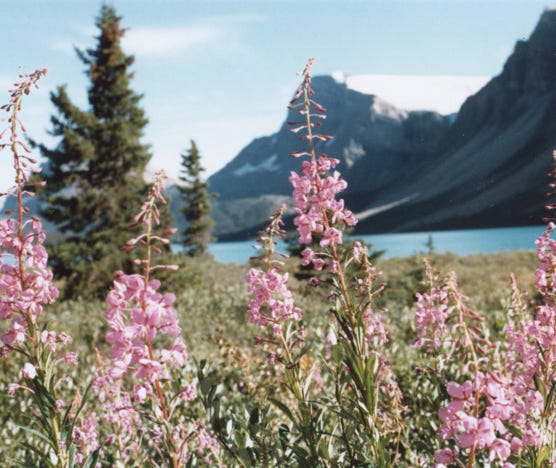
The photos above are of Vermilion River Falls on Numa Creek and wildflowers in the park.
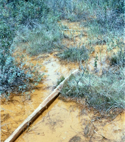
As we hike along the trails, you will see “The Paint Pots”; these unusual iron-rich ochre beds were important to many First Nations people who gathered the ochre for centuries for use in ceremony and trade.
In the early 1900s ochre was mined and shipped to Calgary, where it was used as a pigment in paint. The paint was also used by the Indians to decorate their skin and teepees.
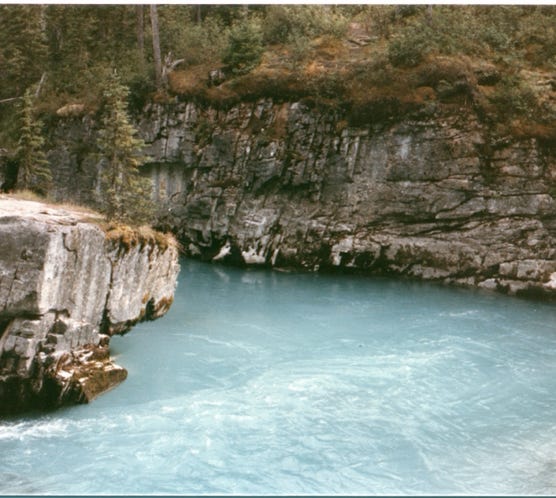
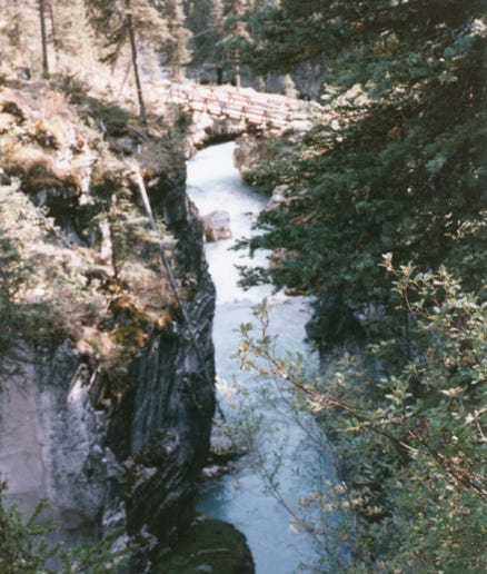
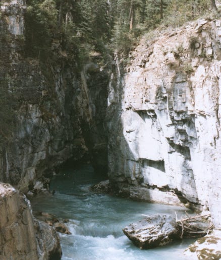
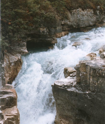
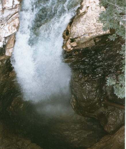
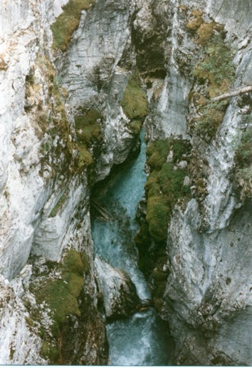
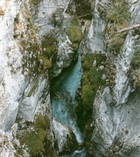
We hiked up to Marble Canyon and the falls. The canyon surrounds Tokumm Creek just above its confluence with the Vermilion River, at the north end of Kootenay National Park.
This is a beautiful turquoise, glacial water flowing from Marble Canyon. Nancy is standing on an overlook by the falls, and the gorge is 1,000 feet deep
As we continued on our trip we took Highway 93 to Alberta, Canada, and took a photo of Castle Mountain in Banff National Park. A view of Sulphur Mountain with an elevation of 8,000 feet.
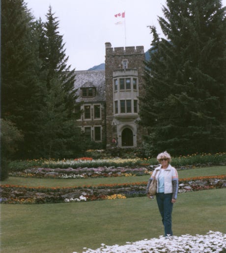
Nancy, standing in front of the Banff National Parks Administration Building.
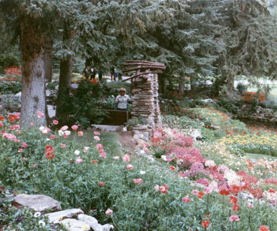
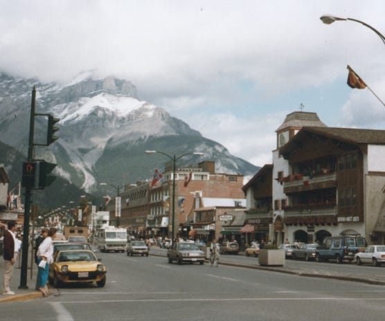
This area is beautiful, the town is quaint; clean, and flowers planted everywhere. A flower garden behind the Administration Building. Downtown Banff with snow on the mountains and this was in August.
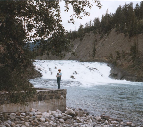
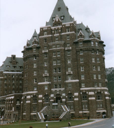
Nancy and Lady at Bow Falls behind the Fairmont Banff Springs Hotel. Banff Spring Hotel opened in 1888 by the Canadian Pacific Railway is spectacular. In 1926 a fire destroyed the original structure on the hotel property and was later replaced in 1928 and was designated as a National Historic Site of Canada in 1988.
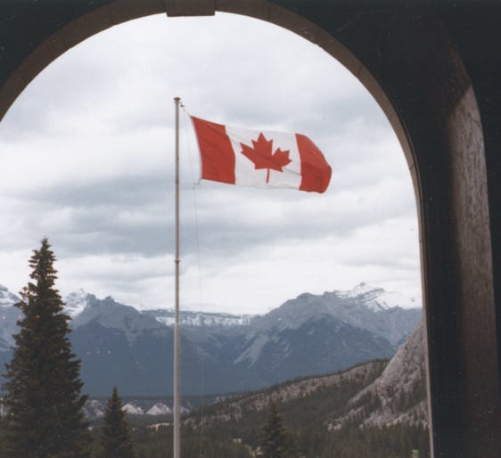
Bill just had to get this great shot of the Canadian Flag through a window from the hotel.
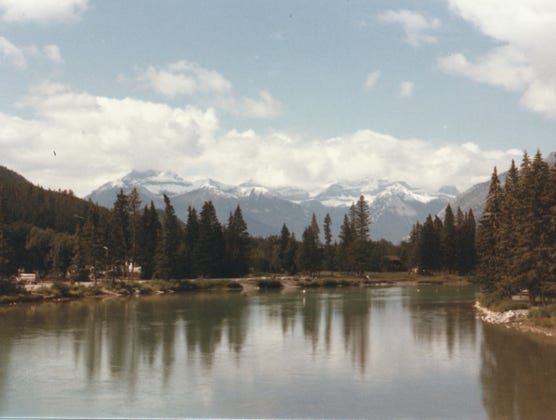
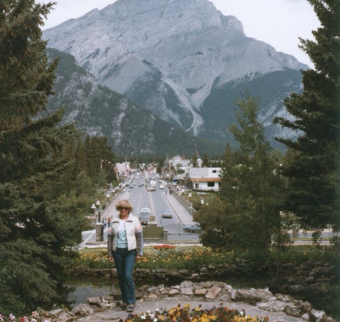
The Bow Falls River and mountains in Banff. Bill and Nancy took the Banff Gondola to Sulphur Mountain with six stunning mountain ranges and sweeping views of Bow Valley, the elevation is 7,500 feet. Banff is Canada’s first National Park founded in 1885, and part of the first national park system in the world. With its soaring peaks, azure lakes, and abundant wildlife, this Rocky Mountain park attracts millions of visitors every year.
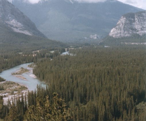
From the summit, Bill took this photo of the Banff Springs Hotel in the background and the Hoodoos and Bow River in the foreground.
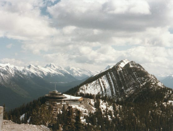
A view of the observation building at the summit of Sulphur Mountain.
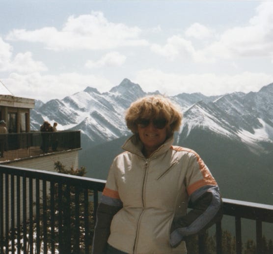
Nancy was on the deck of the observation building with her ski jacket on, although it was summer it was cold on top of the mountain.
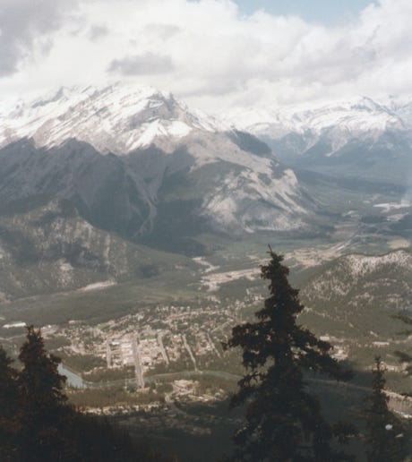
From the summit a view of the Bow Falls River and downtown Banff.
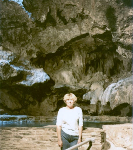
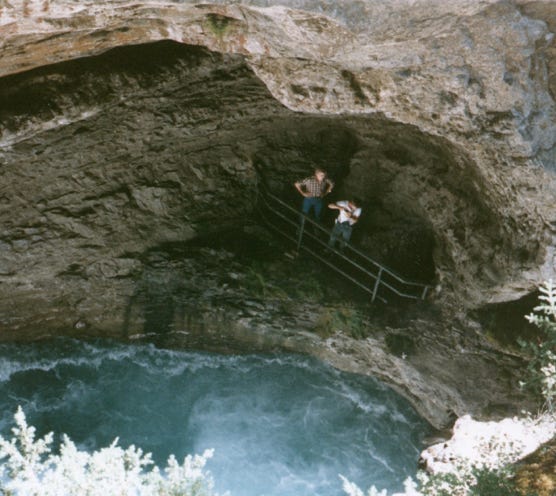
Nancy on the trail of Cave and Basin, a historic site that is the reason that Banff National Park and the entire Canadian National Park system exist. It’s the only hot spring of the nine that has a cavern large enough to accommodate groups of people. This is home to the endangered Banff Snail which is found nowhere else in the world, they are only 0.11 to 0.19 inches in size.
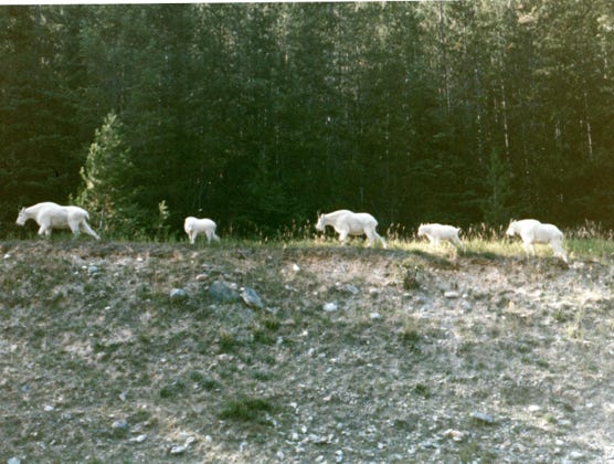
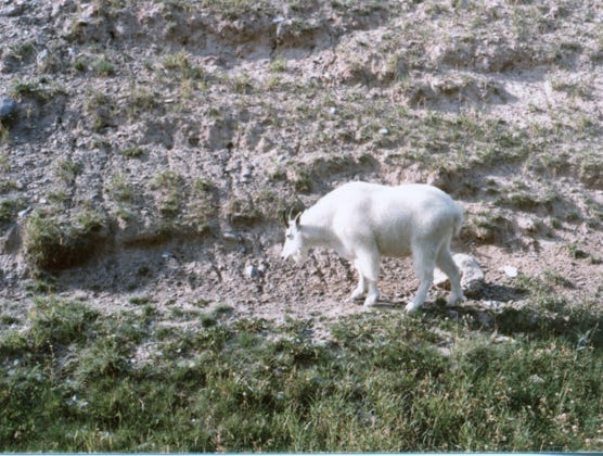
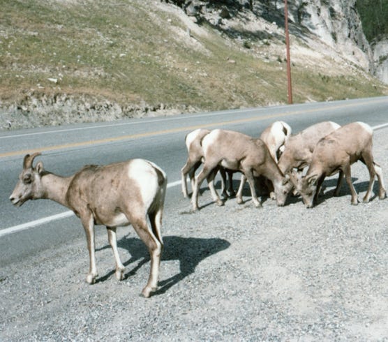
Leaving Banff we are now on the highway and spotting many mountain goats.
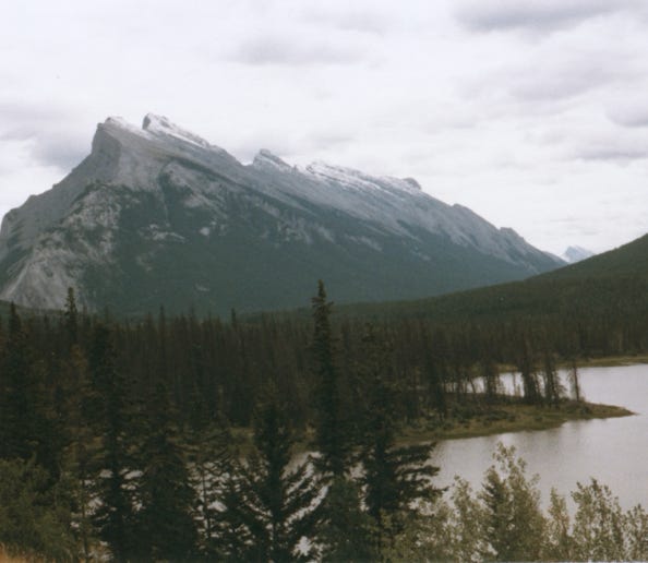
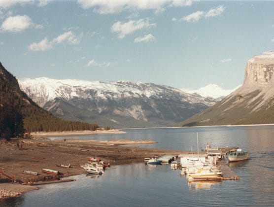
A view of Lake Minnewanka, the largest lake in Banff National Park named “Water of the Spirits” by the First Nations, is a glacial lake fed by the Cascade River. The lake is 13 miles long and 466 feet deep.
You may be wondering how Bill can get such great photos even without a telephoto lens.
He uses a Retina IIIC camera made by German Kodak that he bought in the late 1950s while on a ski trip to Germany. He always used this camera, and every photo of our stories was taken with this camera. It was not until the smartphones and the cameras in them that Nancy said that she wanted to take some photos. The smartphones are easier to use and not as complicated as Bill’s SLR camera. His camera has become a vintage camera, and we don’t use it anymore.
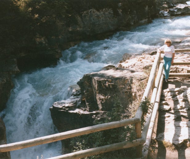
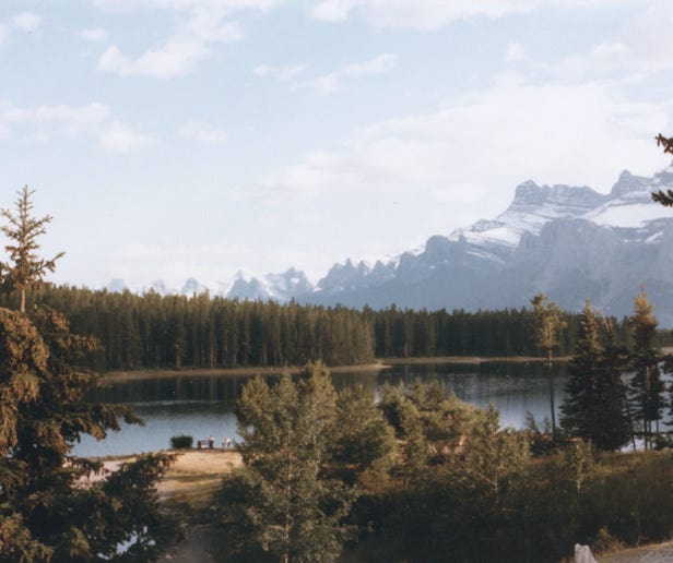
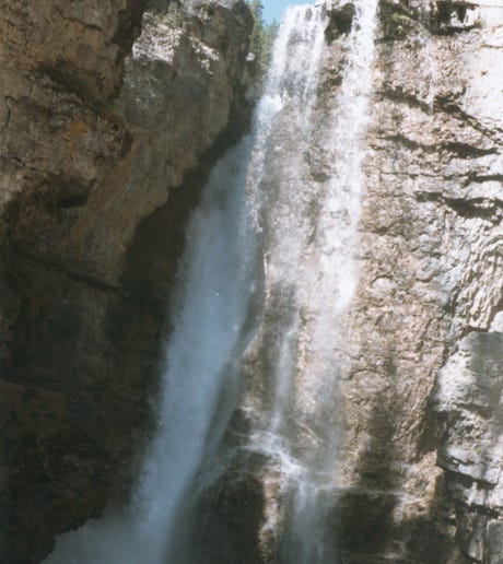
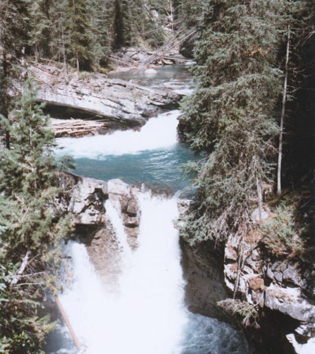
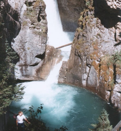
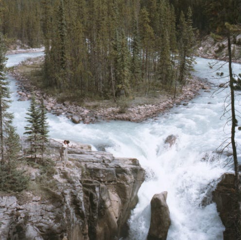
We stopped at every turnout to take photos of Two Jack Lake, and Upper Johnston Falls, and hiked the Johnston Trail.
You can see a large whirlpool at Johnston Falls and the lower Johnston Falls.
This is one of the most popular day hikes in Banff National Park.
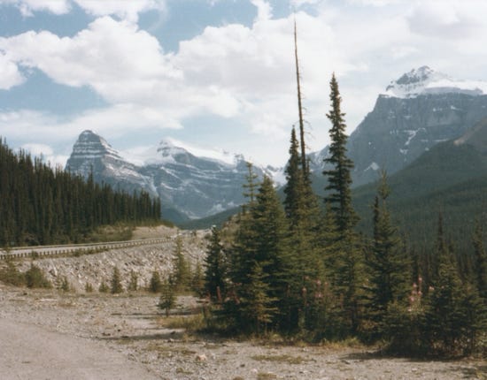
Driving along the Trans-Canada Highway that connects Banff and Lake Louise, as part of its route which reaches across Canada from the west coast to the east coast.
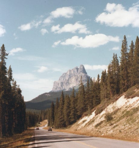
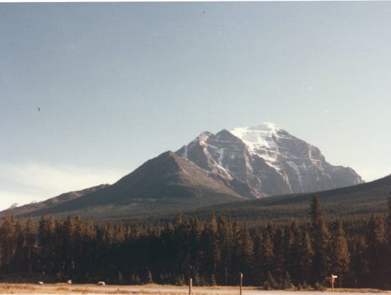
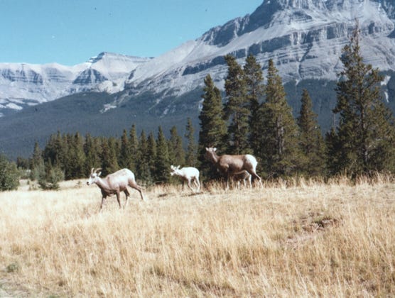
A view of Castle Mountain and Mountain Sheep along the highway.
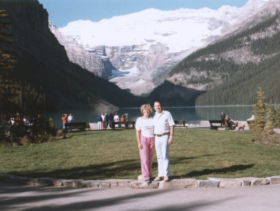
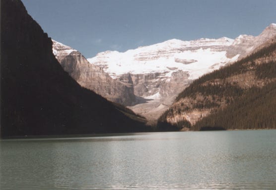
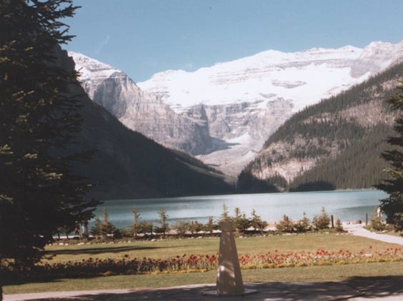
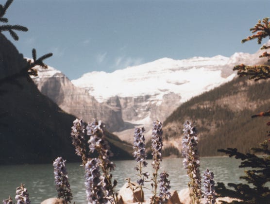
Here we are at Lake Louise with the majestic Victoria Glacier and the glistening emerald lake in the background.
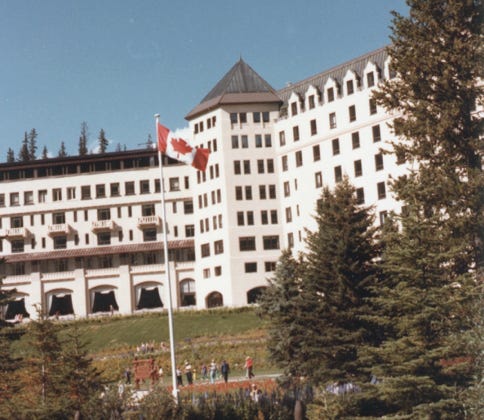
Here is the famous Fairmont Chateau Lake Louise built over 100 years ago. This is a year-round luxury mountain resort providing summer activities such as hiking, canoeing, fishing, downhill skiing, and other winter sports.
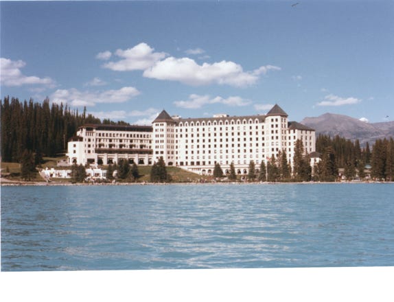
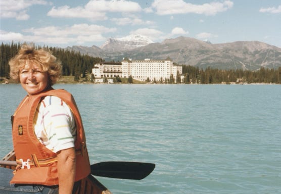
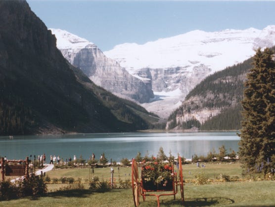
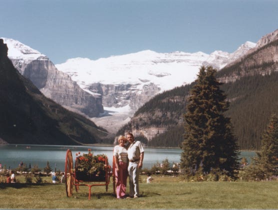
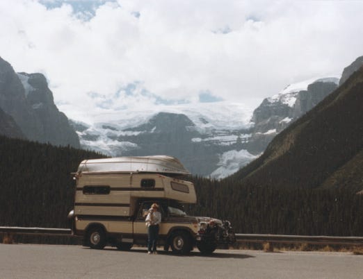
Bill and Nancy rented a canoe and paddled across the lake to take these great shots of the Chateau and mountains. This is such a great place so you will see many photos of the area. This is Victoria Glacier which feeds Lake Louise.
Here, we are taking the gondola to the mountaintop to get this great view, and Victoria Mountain.
Mt. Victoria probably holds the title of the most photographed mountain in North America, possibly the world.
Millions of people view this beautiful area and the mountain was named in honor of Queen Victoria.
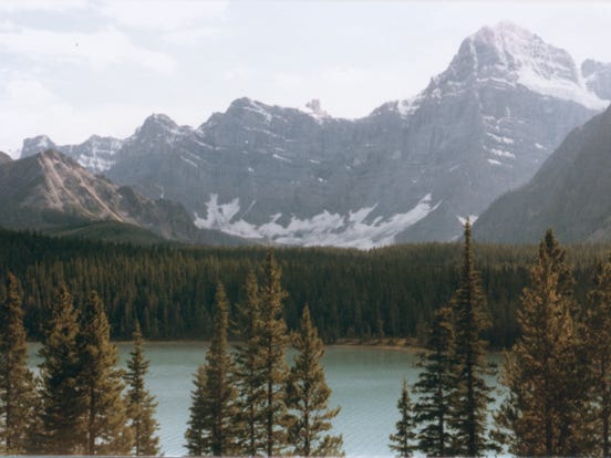
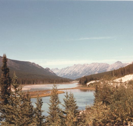
A photo of Hector Lake which is the largest natural lake in the park, and Crowfoot Glacier along the Icefield Parkway. Crowfoot extends two long toes and a shorter one into view from a hidden ice field behind the cliffs, rather resembling the foot of a crow.
Bow Lake and Waputik Icefield which straddles the Great divide
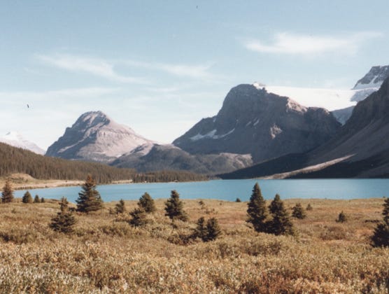
Another view of Bow Lake.
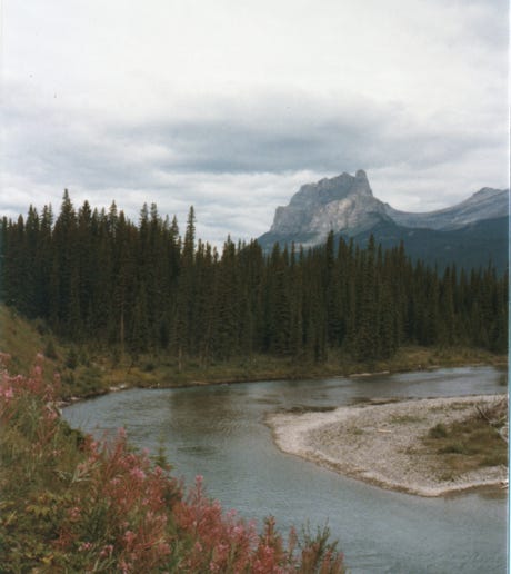
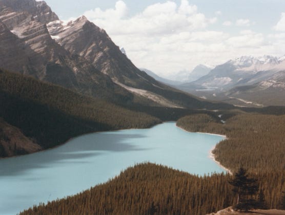
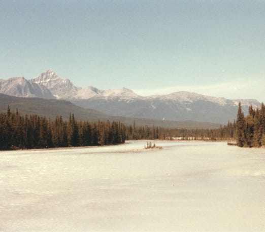
From the highway is a photo of Pevto Lake, and its emerald-colored waters. The color changes with the seasons, before heavy melting in the spring, the lake is a dark blue. As the glaciers melt, their water picks up silt on its way to the lake and a muddy cloud may be seen entering the head of the lake at the delta contrasting with the clear green water at the opposite end.
Bow Summit’s elevation is 6,800 feet above sea level, and Bow Pass is the highest point on the Icefield Parkway between Banff and Jasper and the location for the headwaters of Bow Lake and Bow River.
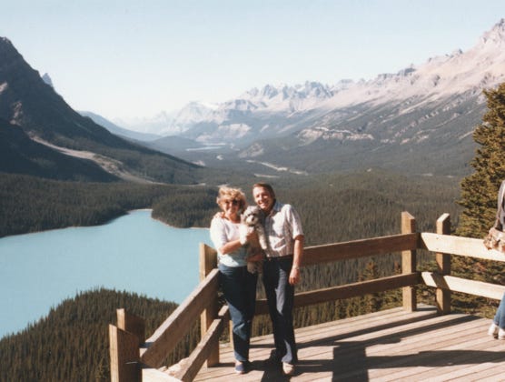
Well, now you see me again in a photo, it’s about time that I see this beautiful lake. Bill, Nancy, and me at an overlook of Pevto Lake.
Driving along the highway, you can see Patterson Mountain and more mountain sheep.
A view of Waterfall Lake, and Mount Wilson.
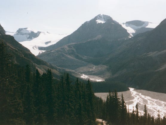
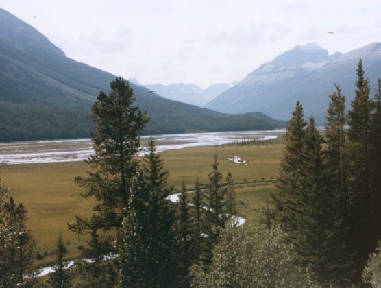
The North Saskatchewan River flows east from Saskatchewan Crossing, out of Banff, into what is known as David Thompson Country, and onto Edmonton.
The Icefields Parkway follows the North Saskatchewan River up to the Columbia Icefield.
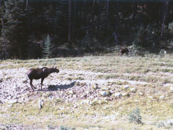
Moose along the highway.
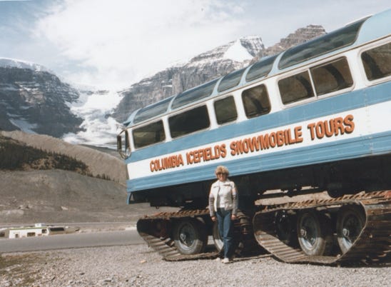
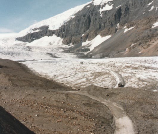
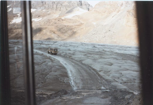
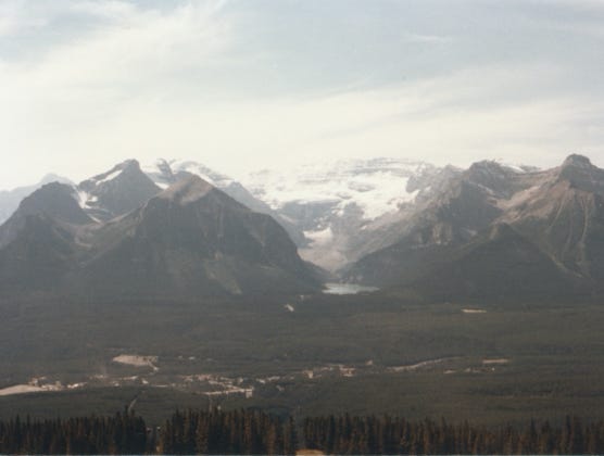
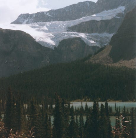
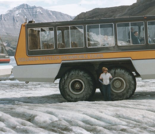
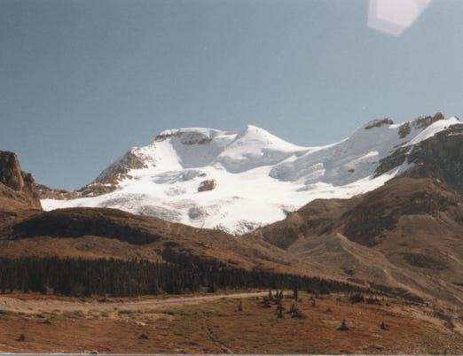
We are now at Columbia Icefield where Bill and Nancy took the snowmobile tour to the glacier. Columbia Glacier is 250 square miles and the Athabasca and Dome Glacier are in the background.
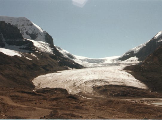
The Columbia Icefield is the largest ice field in the Rocky Mountains
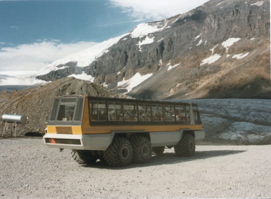
We are now on our way to the Columbia Icefield, and working our way up the mountain.
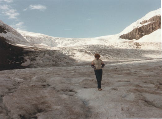
We could not have asked for better weather while on this trip with blue skies and the glacier in the background. Nancy standing on the glacier.
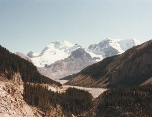
Leaving the area you will see the Columbia Glacier and the canyon in the background.
Nancy and I are in front of the camper at Stutfield Glacier which has a pair of icefields that spills down the face of Mount Stutfield. Stutfield Peak is a mountain in Jasper National Park, Alberta, and is located at the northern end of the Columbia Icefield.
Sunwapta Falls, the Sunwapta River abruptly changes its course from Northwest to Southwest and plunges into a deep canyon. The abrupt right-angle bend was produced by a fault in the rock.
The Athabasca River and Mount Fryatt.
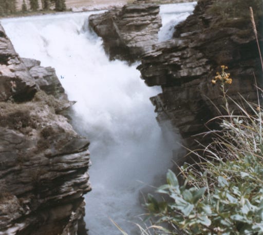
A photo of Athabasca Falls, the force of the Athabasca River funneled into a narrow gorge producing the impressive falls.
Originally, the river cascaded over these cliffs but erosion has gradually moved the falls upstream to their present location.
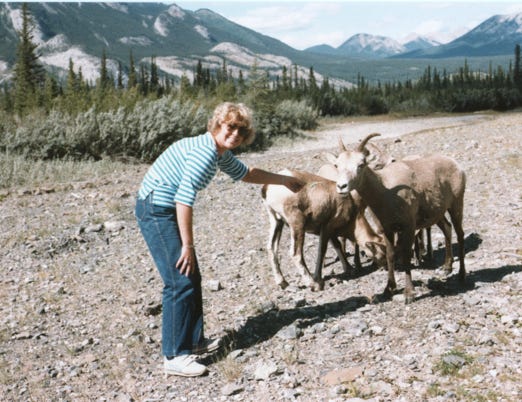
Nancy trying to give a mountain sheep some food.
Arriving at Jasper, we took the Jasper SkyTram up to Whistlers Mountain to get a photo of downtown Jasper. The elevation is 7,496 feet and the tram takes about seven minutes to get to the top.
The town is laid out in the form of the letter J.
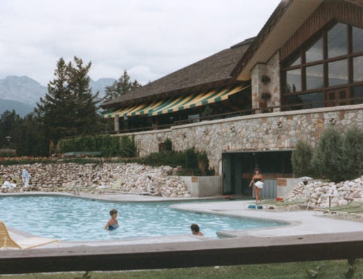
People swimming at Fairmont Jasper Park Lodge. This area is like Banff with many activities year-round.
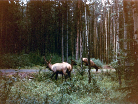
We camped in a wooden area and saw these large Elk roaming in the campground.
We are now on Highway 32 going north to Whitecourt.
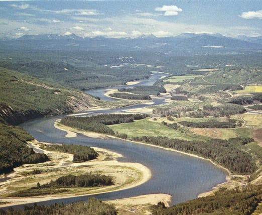
This was a postcard of the 1,195-mile winding Peace River in Canada that originates in the Rocky Mountains of northern British Columbia and flows to the northeast through northern Alberta. The Peace River joins others and the combined Finlay-Peace-Slave-Mackenzie river system is the 13th longest river system in the world.
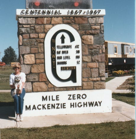
Here, we are at the start of milepost zero on the Mackenzie Highway at Grimshaw, Alberta.
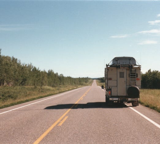
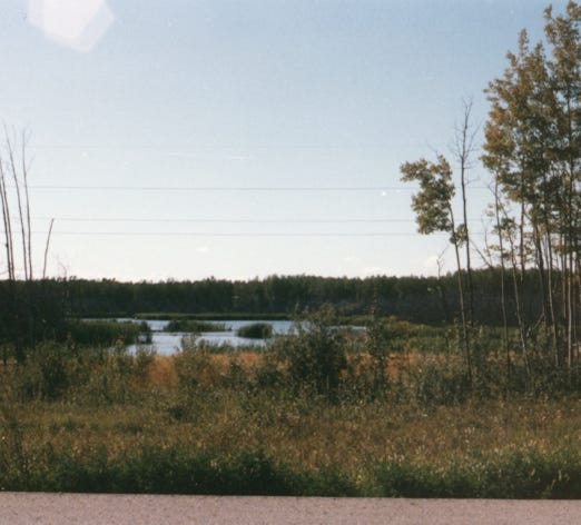
Traveling on Highway 35 to Twin River, heading to Northwest Territories. Scenery along Highway 35.
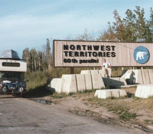
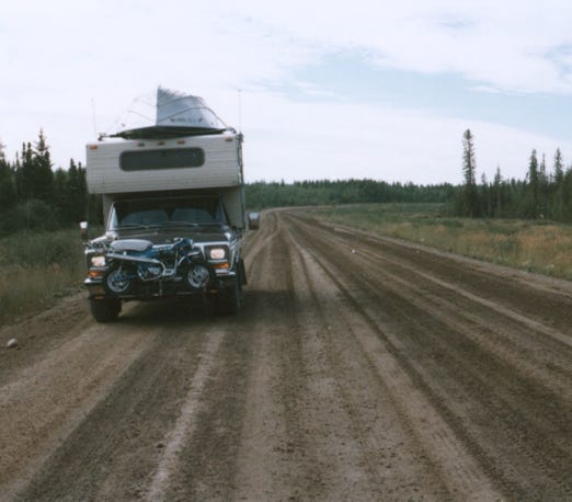
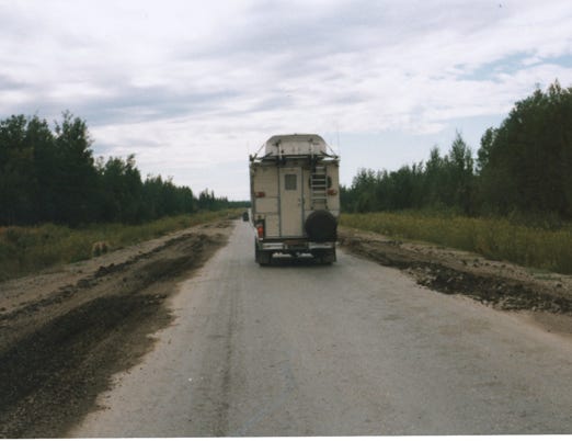
Arrived at Northwest Territories crossing the 60th parallel on our way to Great Slave Lake. Driving on the dirt road on Highway 1 to Hay River.
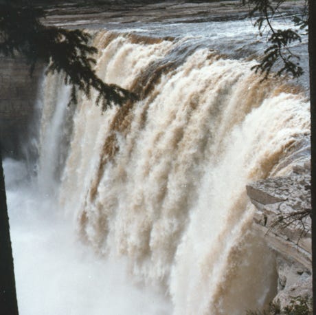
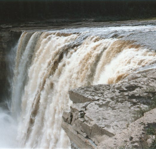
We pass Alexandra Falls along the Hay River; it plunges 110 feet to form the falls at milepost 43. This is the third highest in the NWT and is part of the Twin Falls Gorge Territorial Park.
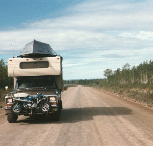
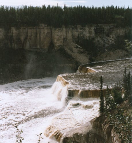
Nancy standing at the edge of the falls. Another photo of the dirt road on Highway 1 going to Hay River.
Louise Falls is downriver from Alexandra Falls, the Hay River plunges another 50 feet in a series of steps on its way to Great Slave Lake.
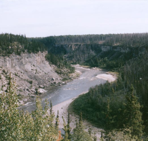
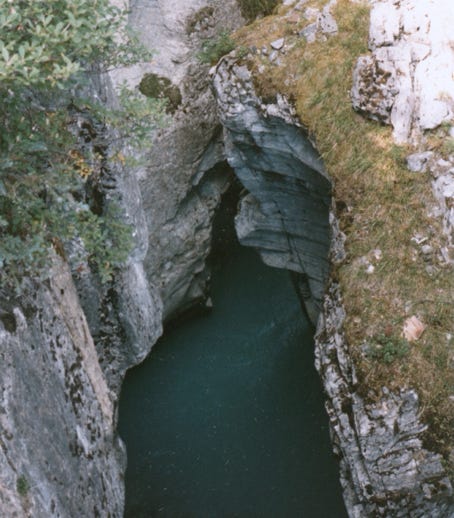
Escarpment Creek and the Hay River on its way to Great Slave Lake. It passes through a gorge that is 170 feet high extending downstream for about 30 feet.
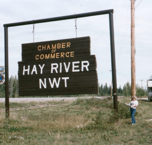
Well, we made it to Hay River, Nancy, and me standing in front of the sign. Hay River is “The Hub of the North” and is a transportation center for the western NWT, with its busy harbor, and Canadian Coast Guard base. The Hay River townsite on Vale Island and the west bank of the Hay River on the east bank is the original settlement site and the location of the only Indian Reserve in NWT.
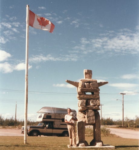
Bill and I standing next to the Invult stone marker in Hay River.
Here, we are standing on the shoreline of Great Slave Lake. Commercial fishing for Lake Trout, Char, Pike, and other fish.
Great Slave Lake is the second-largest lake in the Northwest Territories of Canada after Great Bear Lake, the deepest lake in North America at 2,014 feet, and the tenth-largest lake in the world.
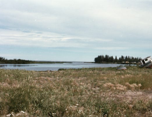
A photo of the Hay River inlet, and Great Slave Lake. We camped by the lake and the one thing that I will never forget was the biggest mosquitoes that I ever saw.
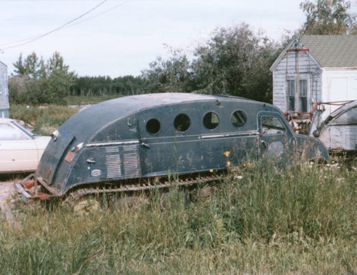
The Indians use these vehicles during the winter to ice fish on Great Slave Lake.
We are now leaving Great Slave Lake heading South on Highway 1, making our stop at a campground called Waskahigan.
In Alberta, they have many free campgrounds like this one which makes it nice to stop for the night.
We are now heading South on Highway 35 to Edson, Alberta, and arrived back at Coeur d’Alene.
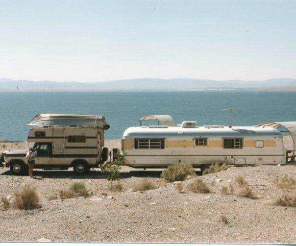
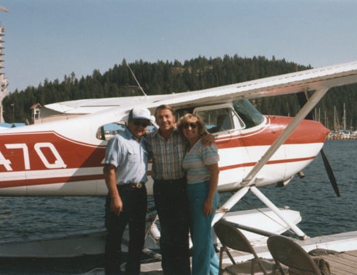
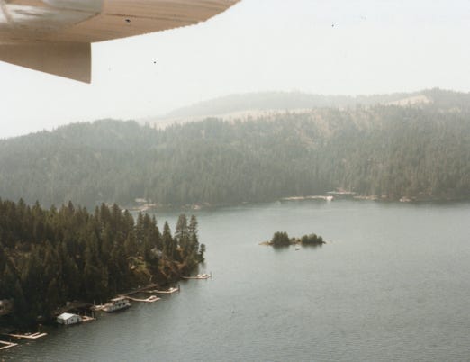
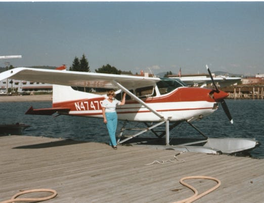
We decided to take a float plane to fly over the lake, and Bill took these photos.
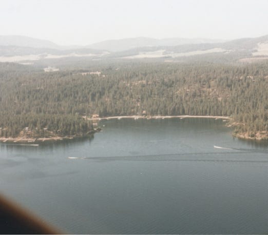
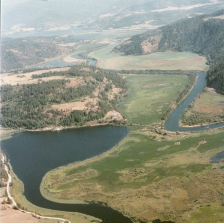
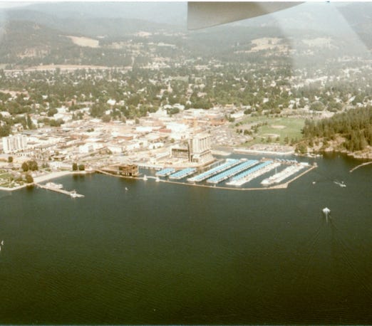
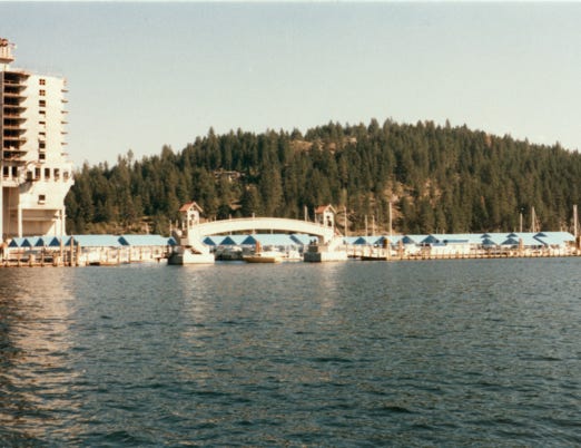
More views from the plane as we cruise over the lake. A view of Coeur d’Alene marina.
Now safely back on the ground, Nancy is standing next to the float plane.
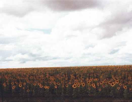
You may remember that we left our trailer in Coeur d’Alene at a trailer park. Once we saw the sites of this area it was time to hook up and head south back to our winter spot at Desert Shores in California. As we went through Oregon we saw a field of sunflowers and took this photo.
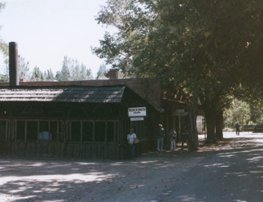
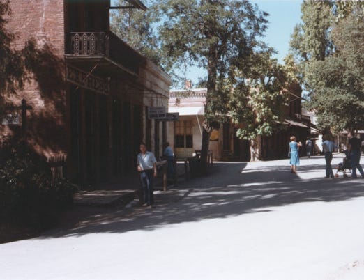
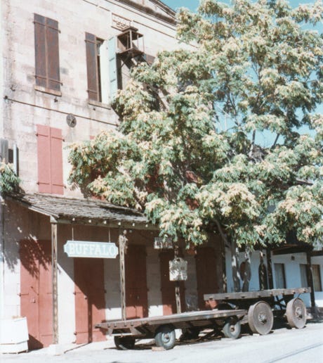
We took State Route 49 and arrived at Columbia, California a town located in the Sierra Nevada foothills. It was founded as a boomtown in 1850 when gold was found in the vicinity, and was known as the “Gem of the Southern Mines.”
Here, we are exploring downtown San Andreas, CA. It was settled by Mexican Gold Miners in 1848 and by 1850 they had over 1,000 people living there looking for gold. In August 1852 the large San Andreas Nugget was found in a claim just north of where the town is located and sold to Wells Fargo company for $12,000. In 1859 over $500,000 in gold dust was shipped.
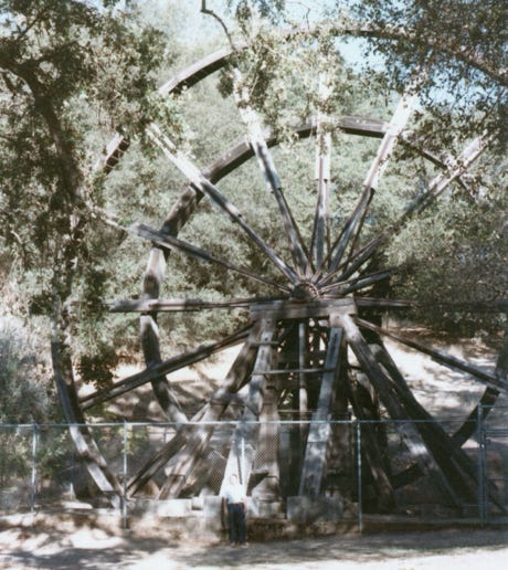
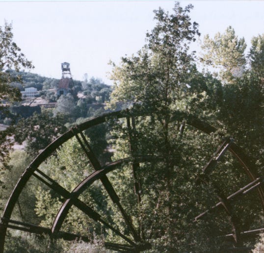
We are now in Jackson, CA at the Kennedy Tailing Wheels Park, one of the deepest mines on the Mother Lode and in the world at a depth of 5,912 feet. It closed in 1942 and is now registered as a California Historical Landmark and has been reopened as a tourist attraction. The Kennedy Gold Mine produced approximately $34,280,000 in gold.
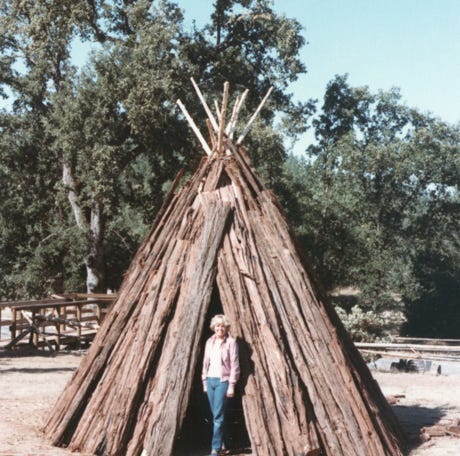
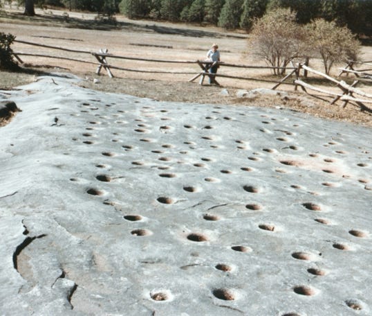
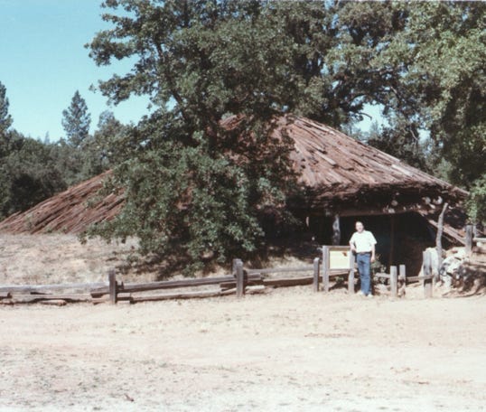
Now, at Indian Grinding Rock State Historic Park in California. This is a marbleized limestone rock formation with over 1,185 mortar holes, the largest collection of bedrock mortars in North America.
It is located about 8 miles east of Jackson, CA. A Miwok village complete with a ceremonial roundhouse that Bill is standing in front of.
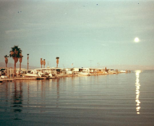
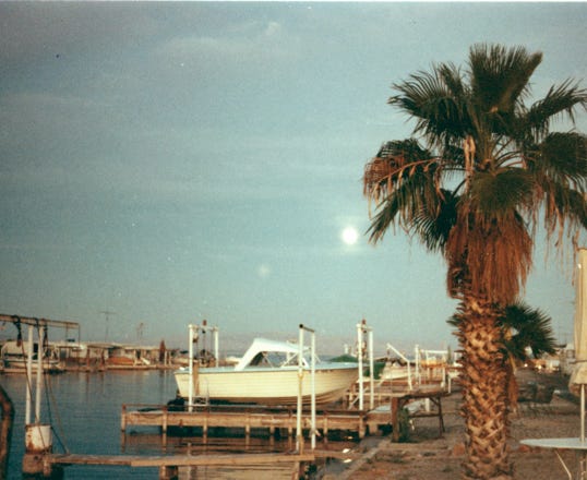
From here our route was back to Desert Shores on the Salton Sea to settle in for the winter. We arrived back in September at our site and got our boat ready to fish the Salton Sea for Corvina, Sargo, and Tilapia.
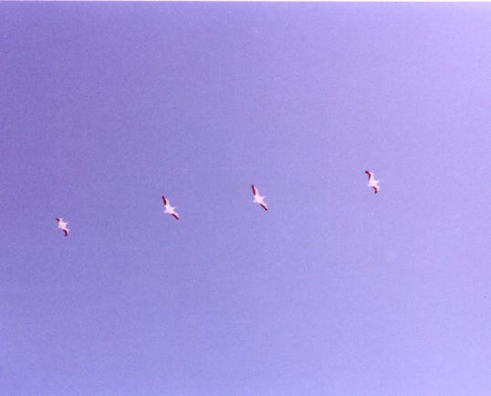
A full moon at the Salton Sea and our boat in a hoist. A flight of Pelicans was captured by Bill.
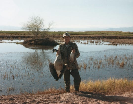
From mid-October to the end of January, Bill, Nancy, and I go duck and goose hunting at the Imperial Wildlife Area called Wister. In December, a photo of Bill’s Canadian Honker and a Pintail duck.
Nancy has several recipes for cooking duck and geese and they never go to waste.
Now what is ahead for next year, come back to see their next adventure with the three of us.