INSIDE PASSAGE FROM VANCOUVER ISLAND, CANADA
TO SKAGWAY, ALASKA

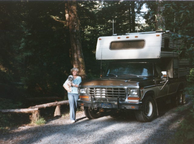
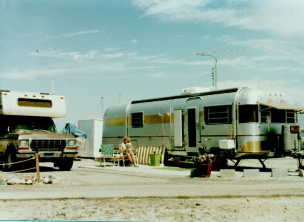
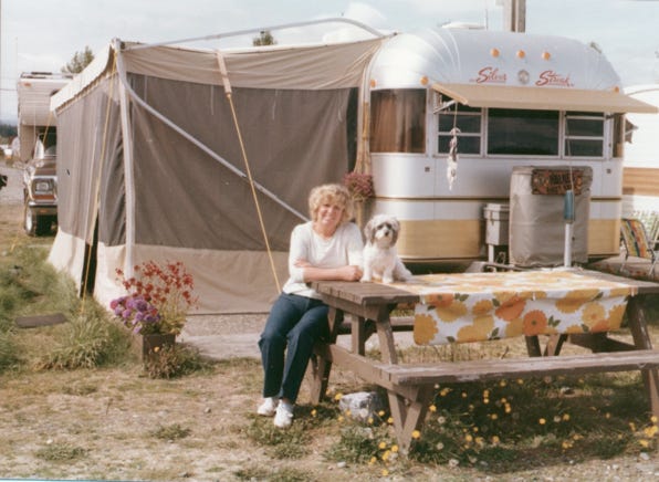
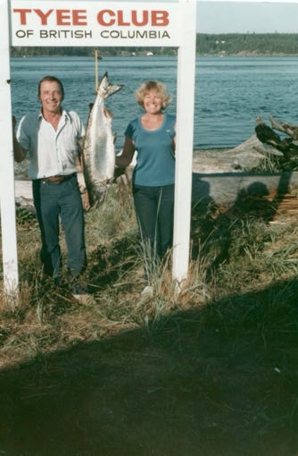
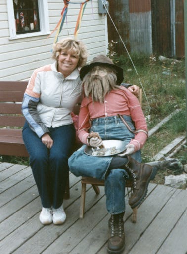
Nancy and Lady Camping in Sitka, Alaska
Come follow us as we board the Canadian and Alaska ferry system from Vancouver Island to Skagway, Alaska.
After we finished “Our Grand Tour,” from 1981 to 1982 which took us from the West Coast to the East Coast we decided to go to Vancouver Island for some salmon fishing. Our first trip was in 1982 when we went to Vancouver Island for three months of fishing, sightseeing, and other things in between. We always took our time to get to the island because our reservation at the trailer park was for the middle of June.
In 1984 we knew that this would be our last trip to Vancouver Island since we wanted to travel to other places during the summer. We planned and decided that after the salmon fishing slowed down in August we would make our trip to the Alaska Inside Passage. During the winter of 1983, we planned our route and stops and made reservations on the Canadian and Alaska ferry system, stopping at various ports as we traveled up to Skagway.
After we retired in 1980 we made our winter home base at Desert Shores, California at Marina Mobile Estates. This was a resort community established back in the ‘50s, and the marina constructed jetties out into the Salton Sea. Over the years people bought manufactured homes and RV’s and had them on their site that they rented by the month or year.
We chose this area because of all of the activities that we liked to do in the winter, and it was a short drive to visit family in the San Diego area.
This is the site that we stayed at for six months, then left during the hot summer months to travel across areas of the West.
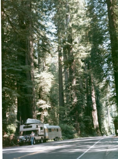
We left Salton Sea in June and traveled north stopping at the Redwoods National Park, and arrived at Horseshoe Bay and boarded the ferry to Vancouver Island.
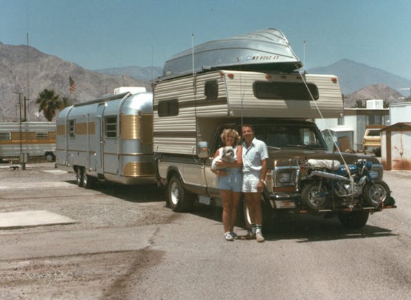
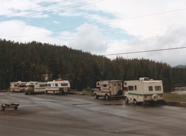
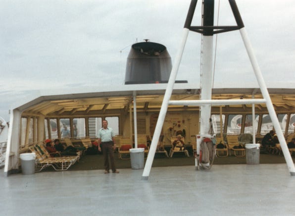
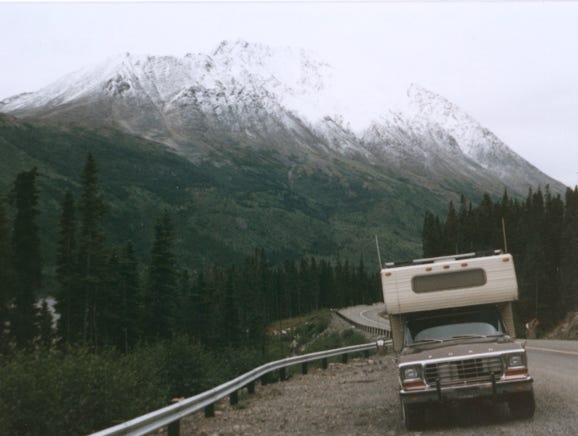
Our rig is 58 feet long and 12 feet high with the boat on top of the camper, so this made for an exciting way to board the ferry.
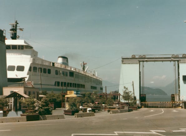
Waiting to board the ferry to get to Vancouver Island.
We arrived at the Silver King Trailer Park on Vancouver Island and took several days to get settled in with the trailer at its site and the boat in the water for some fishing.
At the park, they have moorings out in the ocean with a pulley system, so once the boat is in the water you just go down to the shoreline and pull the ropes to bring it back into shore to load tackle, and off we go to fish for salmon and cod.
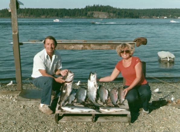

You can see by the photos that we caught a lot of salmon and smoked and canned salmon to bring back home with us.
During this time, we also dug for clams and even found a way to use a stick to poke into the sand when the tide was low to find crabs.
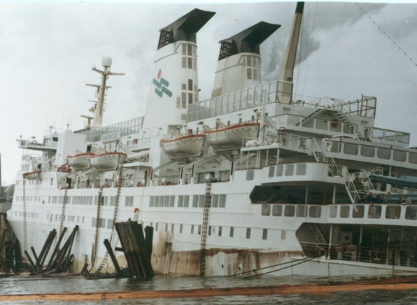
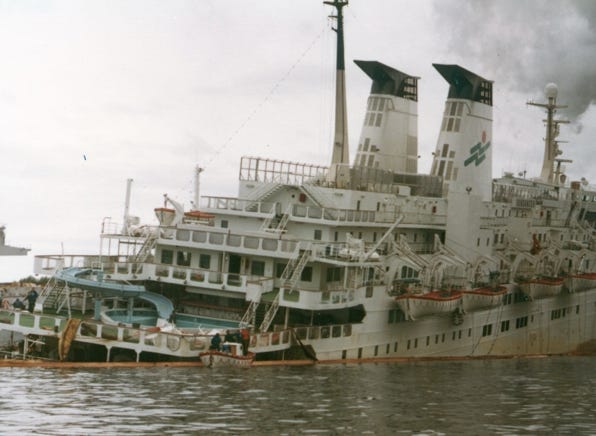
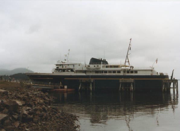
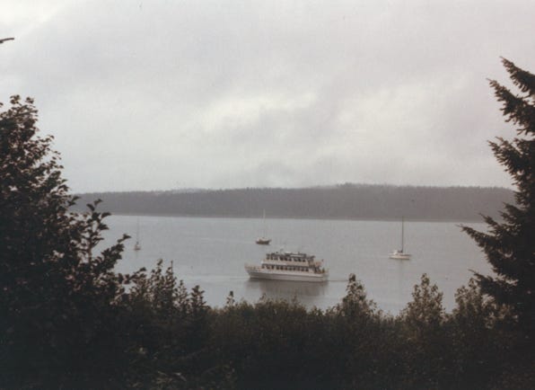
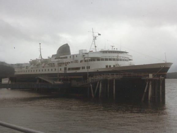
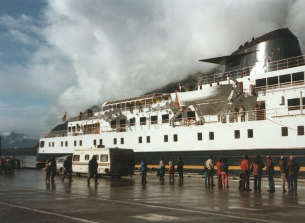
On June 29, 1984, you will see the M.V. Sundancer a 50 million dollar ship on its third sailing to Alaska struck rocks on Maude Island tearing a 30-foot hole in the hull. We heard about this at the trailer park and many of us got into our boats to boat two miles to the area and took photos of the accident.
When the ship realized that it struck the rocks it was able to turn around and slowly sailed to Elk Falls Mill dock and landed next to the dock, as it was taking on water it slowly sank to the bottom and destroyed the 1.7 million Elk Falls Mill dock.
There were 800 passengers, and crew who had to be evacuated from the 12,000-ton ship. We heard that the ship was later declared a total loss.
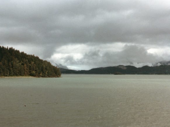
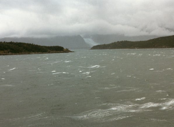
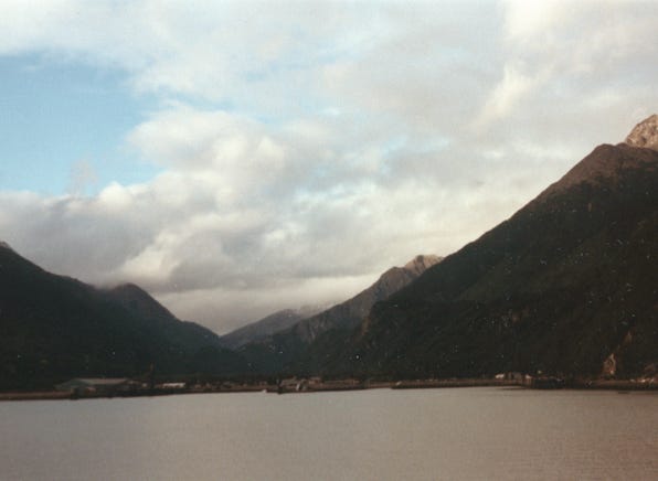
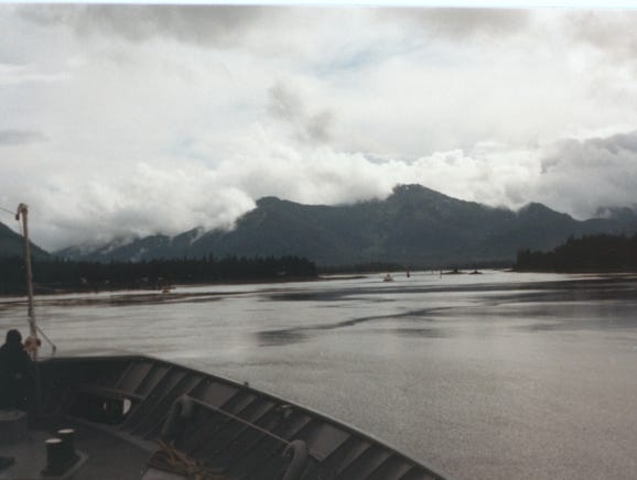
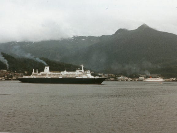
This area is the start of the “Inside Passage,” on your way north to Prince Rupert, Canada, and to Skagway, Alaska. With our small 15-foot aluminum boat and our, 25 hp motor we had to be careful of the large wakes that the cruise ship makes going up the channel. Boating here was always an adventure and exciting with floating logs, killer Wales, and large whirlpools that could take a boat down and sink them which did happen.
In August as fishing slowed down it was time to get the camper and truck ready for our “Inside Passage,” trip. We pulled the boat out of the water stored it next to the trailer and started our adventure.
This was a four-week trip, leaving in August and getting back to the island after Labor Day. Our total miles were 2,000 by sea, 700 miles by land, and 200 miles by air.
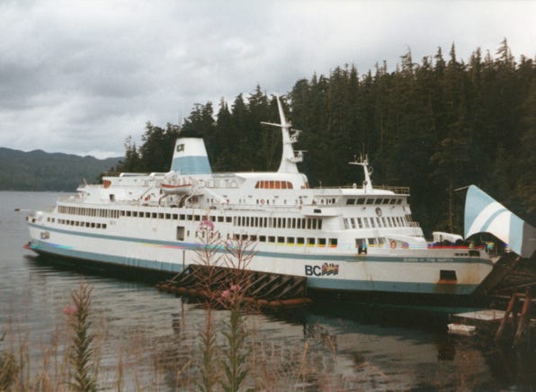
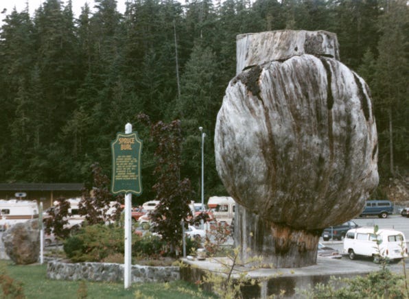
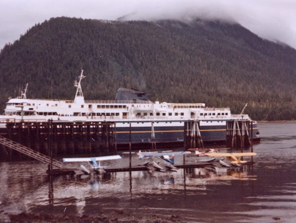
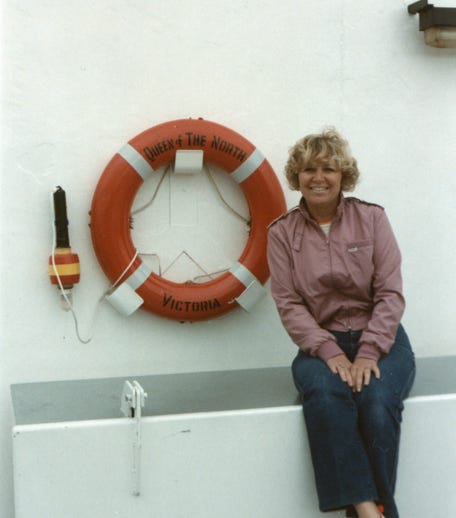
We drove north to Port Hardy, B.C., and waited in line to board the M.V. Queen of the North at an area by the ferry terminal. The M.V. Queen of the North is 410 feet long and a beautiful ship. As many of us waited to drive our rigs onto the ship we took a photo of the “Sitka Spruce Burl.” It is 30 feet in diameter and weighs 7 tons, located next to the ferry terminal.
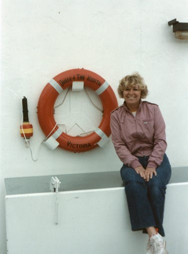
The ferry system allows pets to be in their owner’s rigs on the bottom deck and while I was unhappy being alone, I knew that Bill and Nancy would be able to come down and see me and give me walks.
Now as the ship was sailing away, Nancy was in the lobby of the ship and we were heading north to Prince Rupert, B.C. Bill was on the deck and the solarium area of the ship.
Bill and Nancy decided that they wanted to take the camper and truck on this trip rather than board as a passenger and get staterooms because that meant that I would have to be boarded at a vet while they took this trip. Also, they wanted to get off at the ports drive the area, and explore the sites.
Arriving at Prince Rupert, B.C. gave me time to go for walks and get some fresh air before being loaded back in the camper and on the lower deck.
We left Prince Rupert on the Alaskan ferry called M.V. Malaspina. This is 408 feet long and carries 750 passengers and 120 vehicles.
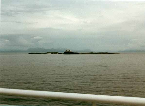
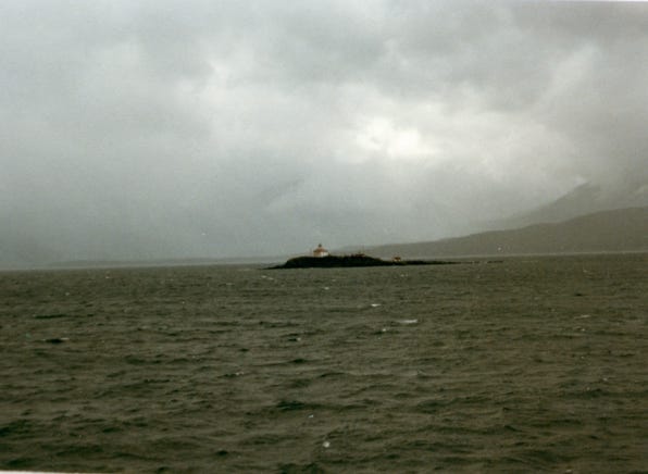
The photo is of “Three Island Lighthouse,” completely automated, it is located in the Chatham Sound between Prince Rupert and Ketchikan.
When you plan this type of trip, you have to look at the ferry schedule to determine what ports you will get off going north and then coming back south. So we did not get off at Ketchikan, AK, we stayed on the ship to Sitka.
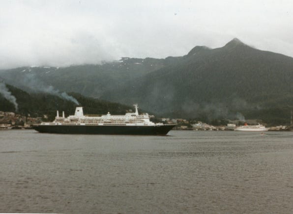
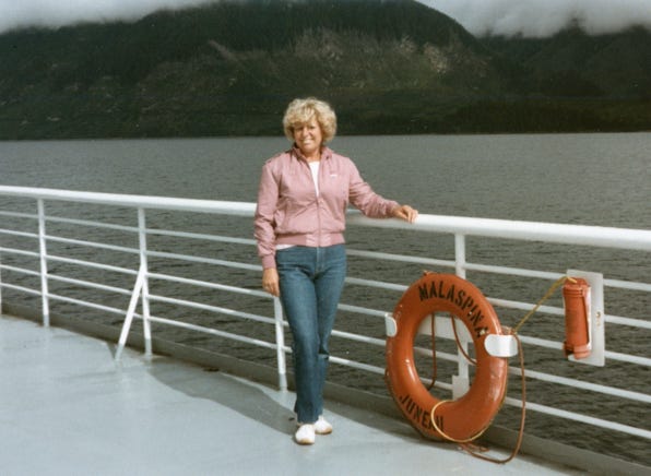
You will see in the photo the City of Ketchikan on Revillagigedo Island, and the cruise ships Nordham and Cunard Princess in port. Nancy is on the deck of the M.V. Malaspina in Peril Strait on the way to Sitka.
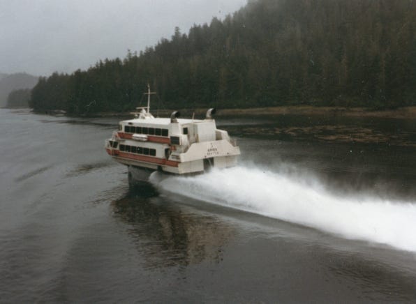
You will see a photo of Boeing’s Aries Hydrofoil which cruises at 50 mph and services seven ports in Alaska.
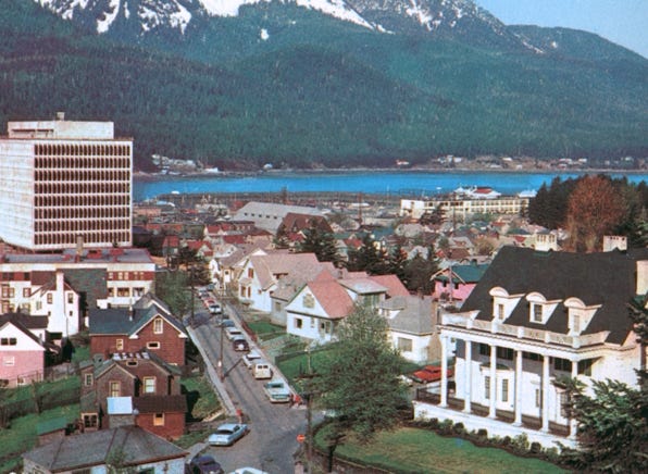
Yeah, we arrived at Sitka, AK and I was able to get out of the camper and got to dry ground, well sort of. It is always cloudy here and damp.
Sitka is called “Paris Of The Pacific,” located on Baranof Island. In 1799 Count Baranof made Sitka the capital of Russian America. On October 18, 1867, Russia sold Alaska to the United States for $7,200,000. From 1867 to 1906 Sitka was the capital of Alaska. In 1906 Juneau became the capital.
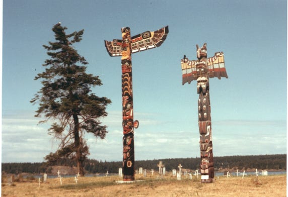
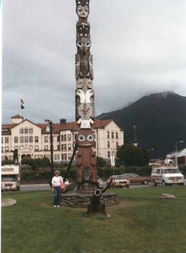
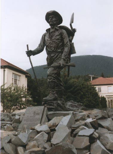
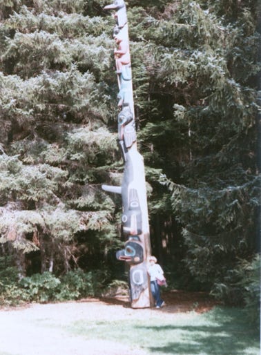
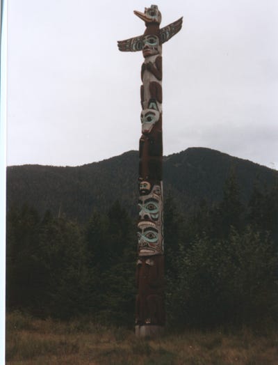
This photo shows the main square totem with the “Pioneer’s Home,” in the background. The statue is called “The Prospector,” located in front of the pioneer house. The population of Sitka at the time of our trip was 7,900, and the annual rainfall is 100 inches a year, no wonder my feet are always wet!
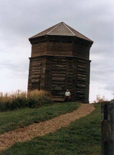
Bill standing in front of the Russian Blockhouse. This stout structure is a re-creation of the guard tower that once stood here, part of the fortress enclosing the Russians during their time in Sitka, from 1804 to 1867. Fearful of the wilderness around them, and Tlingit Natives, the Russians’ enclosed fort was open to outsiders only in the daytime. A massive fence, with three guard towers like this block tower, separated the fort from the rest of Baranof Island. The tower is closed, but you can get a feel for the Russian fortification and mindset with a visit here.
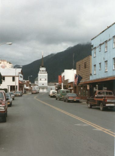
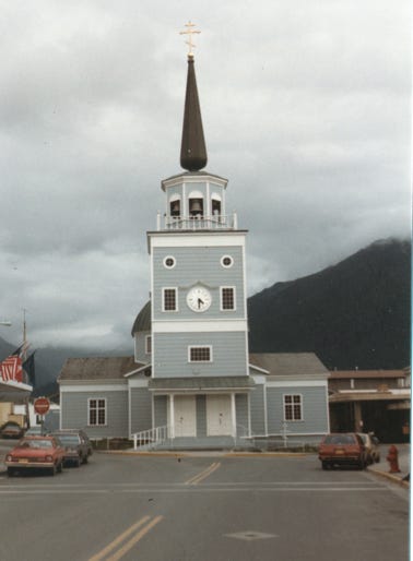
This is downtown Sitka, and St. Michael Cathedral National Historic Landmark built from 1844 to 1848 by Bishop Innocent Veniaminov on Lincoln Street. Home of priceless original icons and paintings of the Czarist days.
Camping along the Indian River in a lush rainforest in Sitka.
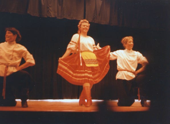
We spent several days in Sitka taking in the sights and one evening Bill, and Nancy went to the Tlingit Centennial Building to see native arts and read about the history of the people.
They saw a show of “Archangel Dancers,” performing various Russian Folk dances and ceremonies.
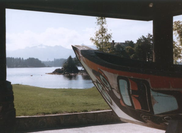
A photo of the Tlingit canoe in the Centennial Building.
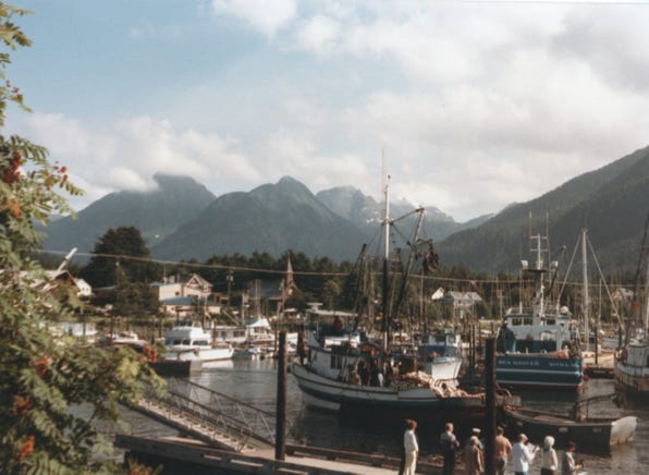
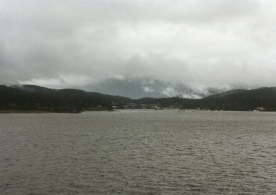
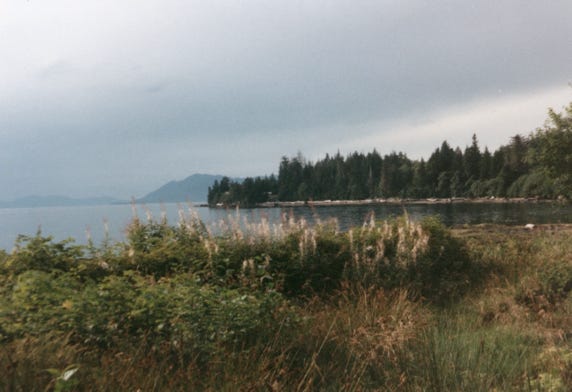
A photo of Sitka harbor.
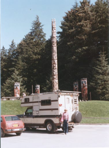
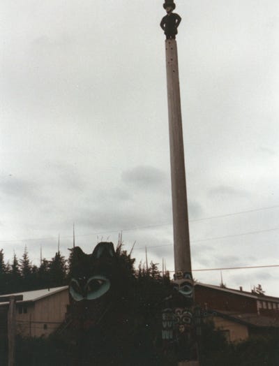
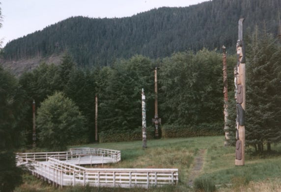
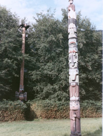
The Sitka National Historical Park is well worth spending time there, you will see many totem poles. This was the site of the 1804 battle between the Tlingit Indians and the Russians called the “Battle Of Alaska.” This was a six-day battle between them and ended with the Russians burning down the Indian fort. After that, the Russian capital thrived.
The park has a collection of totem poles of the Haida and Tsimshian Indians.
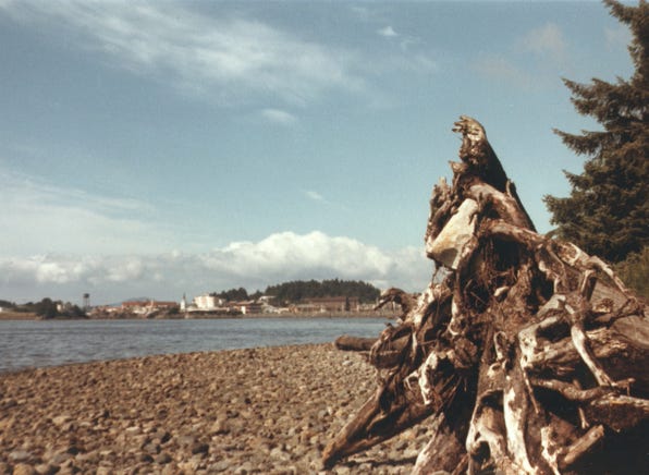
A photo of the beach where the Russians landed in 1804 to fight the “Battle Of Alaska.”
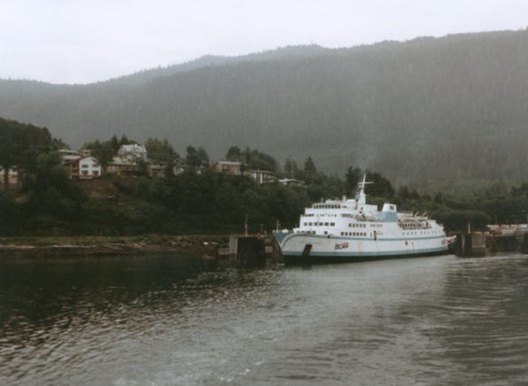
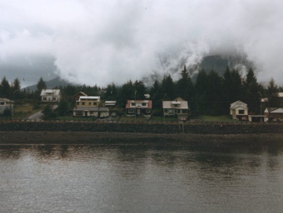
We are now approaching Tenakee Springs, the population at the time of our visit was 142 people.
We were only able to spend several hours walking around the area sightseeing, and I had my usual stops on the shore before going back into the camper.
Tanakee Springs is a small logging and fishing center. But, back in the day, it was called the Alaska Spa, with early miners coming from around the territory and the Yukon to “Take The Waters," of its warm mineral springs.
The M.V. Le Conte at Tenakee Springs, the length of the ship is 235 feet and carries 250 passengers and 47 vehicles.
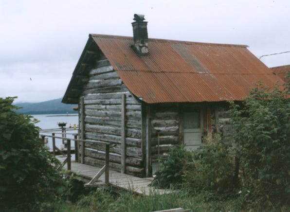
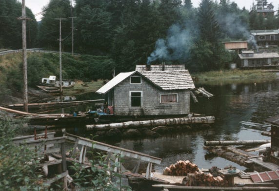
A log cabin on the shoreline of Tenakee Springs.
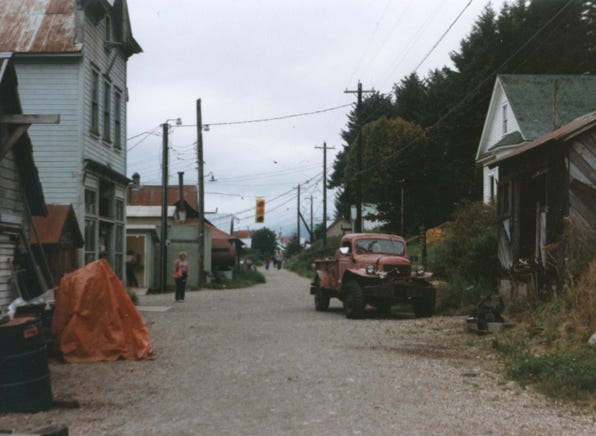
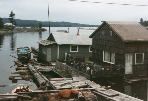
You will see homes along the shoreline and even a roof garden for fresh vegetables. The only road in Tenakee Springs is a one-lane dirt road with one traffic signal.
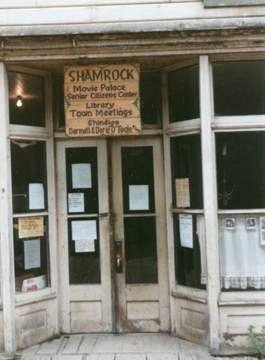
The photo of Tenakee Springs “Town Center,” is called Shamrock it is their movie palace, senior citizens center, library, town meeting hall, and shindigs.
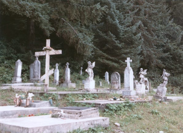
Leaving Tenakee Springs we go to another port called Hoonah. We are only staying here for a few hours, another stop for me to go outside and smell the fresh air.
The M. V. Le Conte is at the dock on Chichagof Island. The island community of Hoonah was once the major village of the Huna Indians. A subdivision of the Tlingit tribe. Fishing and a seafood processing plant is the major industry here.
Two Photos of Hoonah Cemetery.
Now back on the ship, we leave the port of Hoonah and we are speeding towards Juneau. I will like this because we will be spending several days here. Bill and Nancy booked a flight from Juneau to Glacier Bay and will go on another boat to tour all of the glaciers; I will again be waiting in the camper for them to get back to me.
Juneau is now the capital of Alaska and lies along the Gastineau Channel at the foot of Mt. Roberts. The population when we were there was around 19,500 people, their annual rainfall is 92 inches a year.
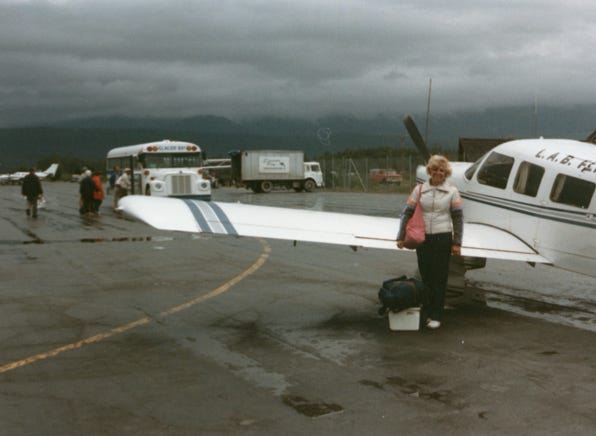
Bill and Nancy found a small RV park to spend the night so they could do laundry fill water tanks and buy groceries. They had a nice Chinese dinner and set their alarm clock for 4:00 AM because they had to be at the airport by 5:00 AM for their flight.
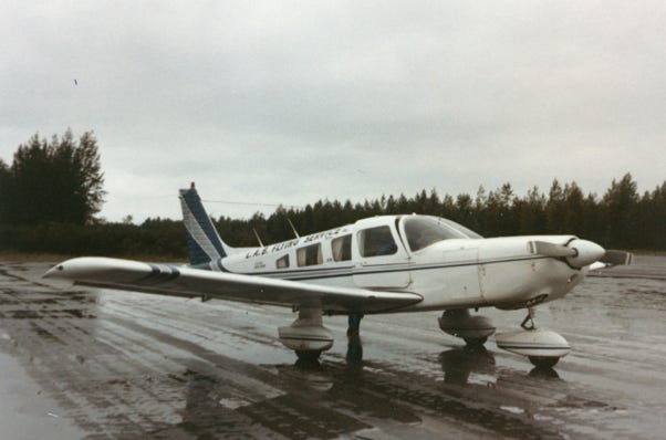
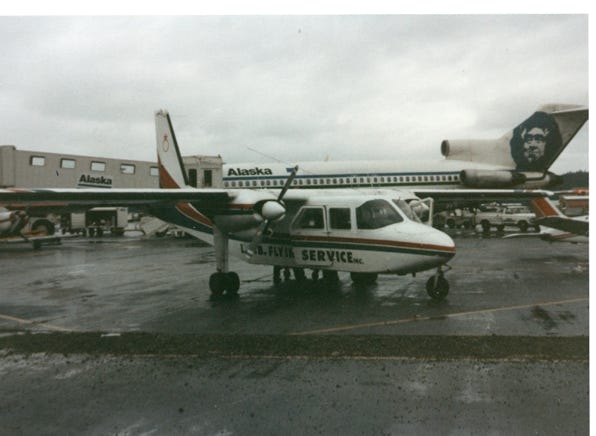
We got there early, and the fog and rain were really bad; you could not even see the mountains. As more people arrived for our flight that only carried six people, other small single-engine planes were waiting for their passengers. Looking out the window, you can see how bad the weather was.
Because of the dense fog, the flight was delayed, and we had to wait for an hour until it cleared for takeoff. Remember that this was all booked and paid for eight months ago, and to miss the flight meant that they may not be able to go to Glacier Bay for the boat tour.
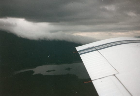
In an hour, we all got to the small single-engine plane and we took off for Glacier Bay. We had a young female pilot, and Nancy sat in the front seat next to her. She hates to fly, and so the pilot thought that she would be more comfortable in the front seat while Bill was taking photos of our flight. You hear so many stories about the small bush planes and crashes because of the bad weather. She took off, and away we went, she was a very good pilot and we landed safely at the airport at Glacier Bay.
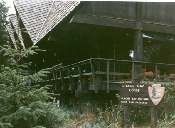
We took a bus for the 15-mile drive to Glacier Bay Lodge and checked in for the tour. Glacier Bay Lodge is 150 years old in a spruce and hemlock forest. This area was once under glaciers thousands of feet deep only 188 years ago.
We boarded the M.V. Thunderbay in Bartlett Cove and off we went.
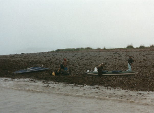
We saw people kayaking and camping in areas of Glacier Bay, but it would be too cold for us, and too wet.
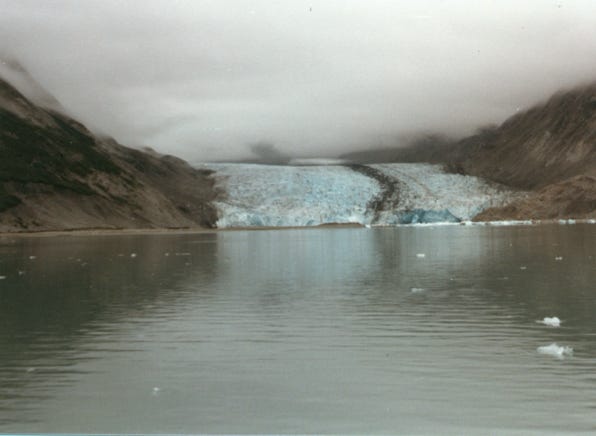
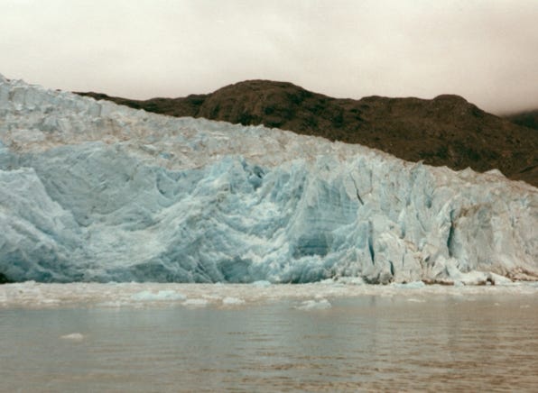
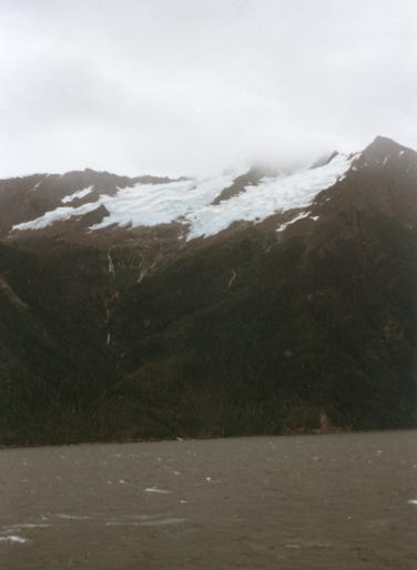
We came across McBride Glacier on Muir Inlet of Glacier Bay which is a tidewater glacier. There are only 30 tidewater glaciers left in the world today, and 16 of those are in Glacier Bay! Southeast Alaska is one of three places in the world where they exist, the others are in Scandinavia and Chile.
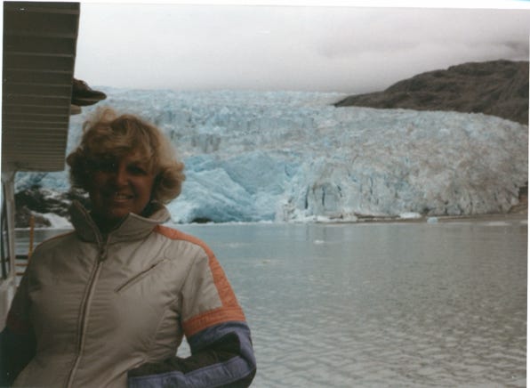
A photo of McBride Glacier and Nancy on the boat.
Glacier Bay was completely covered by ice just 200 years ago. In 1794 Glacier Bay was a barely indented glacier, which was 4,000 feet thick, and 20 miles wide, and 100 miles long.
When John Muir explored Glacier Bay in 1879 the ice had retreated 48 miles up the bay. This rapid retreat is known nowhere else. Today, Glacier Bay has reached nearly 70 miles in length.
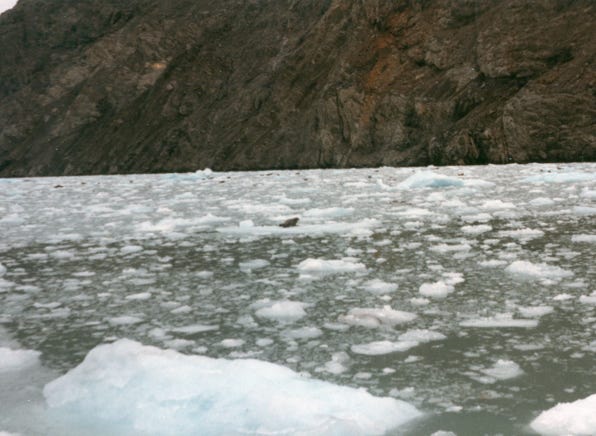
A photo of harbor seals on the floating icebergs.
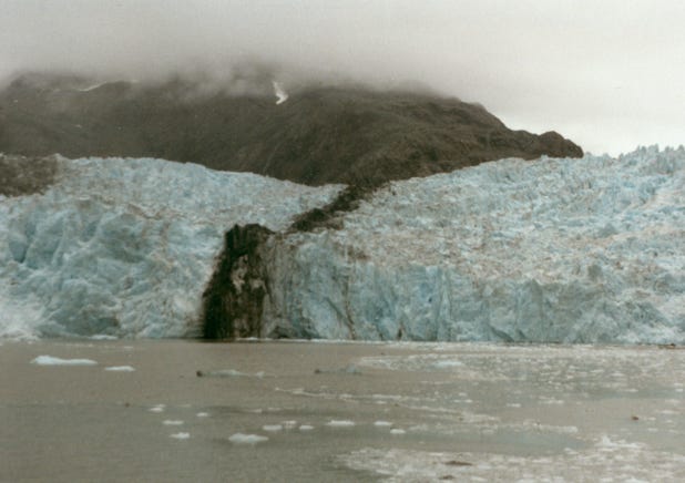
As we boated to more glaciers we came across Riggs Glacier. You can see the harsh beauty of a land just released from the ice. No trees, or bushes, just the brilliance of the grey and browns of a dead land. But, less than 100 years from now it will be a thick forest of alder, cottonwood, and spruce as the ice recedes.
The bay is the home for whales each summer, every year humpback, orca, and minke whales come here to feed before migrating in the fall to Mexico and Hawaii.
Our trip to Glacier Bay was specular, the weather was cloudy with some rain but we saw a lot and took many photos. As we were waiting at Gustavus to board the two-engine plane back to Juneau, we saw the large plane from Alaska Airlines and thought that we were going to take that plane back to Juneau but that was not the case. As we waited in line to board our plane another pilot came to us and said that he would be flying us back. He was much older a “seasoned pilot,” and we were okay with this.
As we approached Juneau “the seasoned pilot,” made some sweeping and banking turns something that no one on the plane appreciated; we just wanted to get back safety. He was trying to beat the large Alaska Airlines plane back and landed in front of the large plane and taxied to a stop. We are now back on dry land (well not dry) but on the ground.
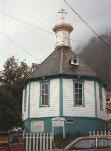
This is a postcard view of downtown Juneau with the Governor’s mansion in the foreground; the mansion was constructed in 1910. You will see St. Nicholas Russian Orthodox Church which was constructed in 1894, this octagonally-shaped building is the oldest Russian Church in Southeast Alaska. Inside they show Russian icons, vestments, and old religious books.
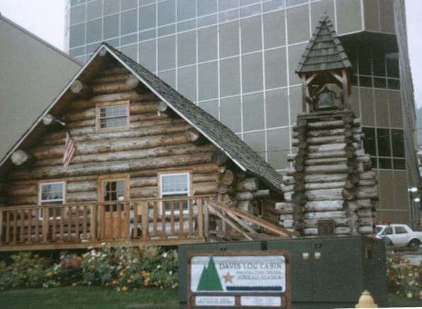
This is Davis Log Cabin, completed during Juneau’s Centennial year of 1980, it is a replica of the first church in Juneau, built in 1881. Used also as a dwelling, a carpentry shop, a school, and a brewery office before it was torn down in 1914. Now, it is a visitor’s center.
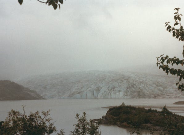
As we drove through the area, we stopped at Mendenhall Glacier and the Juneau Icefield. It is 12 miles long and 1 1/2 miles wide. It was another overcast, cloudy, foggy, rainy day so taking photos in this weather it was hard to capture the size of the glacier.
We left Juneau on the M.V. Malasana and Juneau’s ice field is in the background, 1,500 square miles in size, and is larger than Rhode Island.
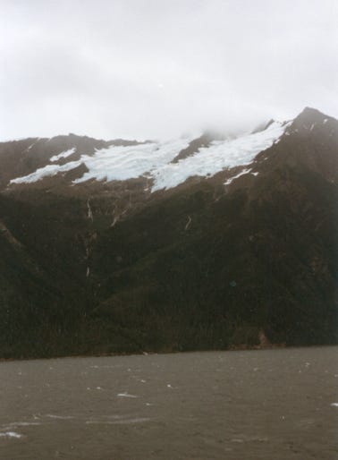
A photo of Eldrid Rock Lighthouse, the last manned lighthouse in Southeast Alaska. Approaching Meade Glacier along the Lynn Canal heading north to Haines.
Another stormy day and you can see Rainbow Glacier along the Chilkat Inlet and rough seas.
We arrived at Haines, Alaska, Lady was glad to finally be on solid ground again. The town lies in a spectacular setting on the Chilkat Peninsula, near the Northern end of Lynn Canal, between Rainbow Glacier, and the coastal range. The population at the time was 1,500, and the annual rainfall was 53 inches a year.
We saw Fort William H. Seward which was established in the early 1900’s. In 1904 it became the regimental headquarters for many soldiers in Alaska.
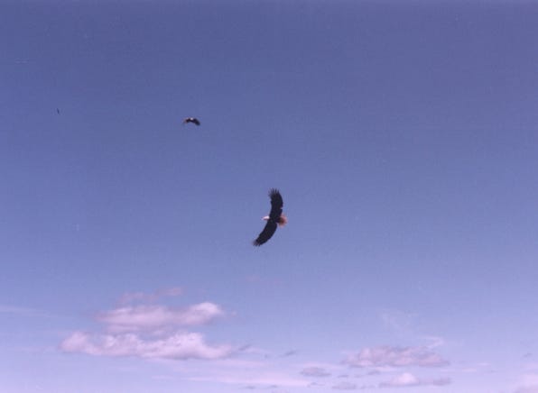
From October to January, Haines hosts approximately 3,500 bald eagles that follow migrating salmon up the Chilkat River. The eagles gather by the hundreds in Cottonwood trees on the river banks as they wait to feed on spawned out salmon.
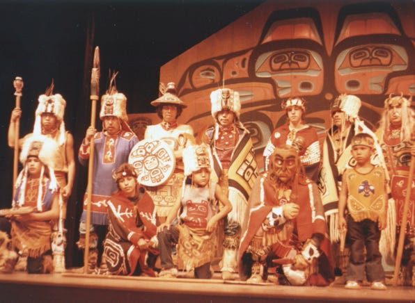
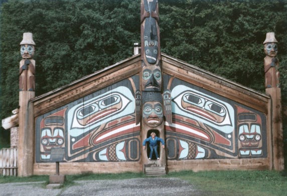
The photo is of the Tlingit Indian Tribal House on the parade ground of Fort Seward.
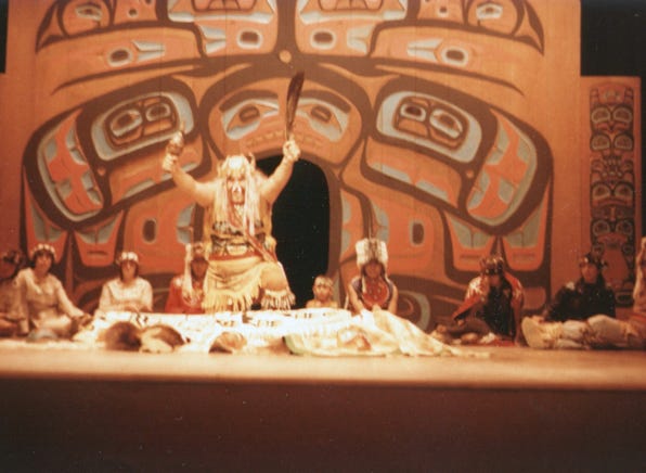
Later that evening we went to see the Chilkat Dancers performing various dances in the tribal house. The costumes are authentic reproductions of the traditional dance theme that they are performing and are made by the performers.
A photo of the “Shaman Dance,” meaning Indian doctor.
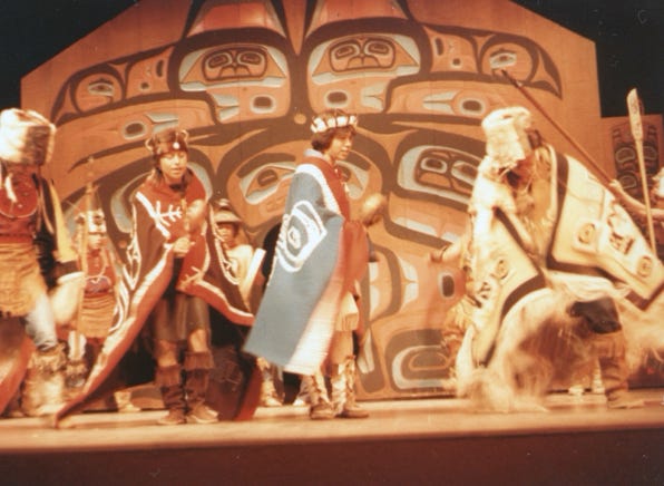
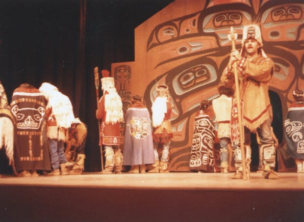
Another dance called “Ptarmigan Dance,” is performed by the group. They use many priceless artifacts, including several Chilkat blankets in all of their performances. A photo of the “Haida Blanket Dance.”
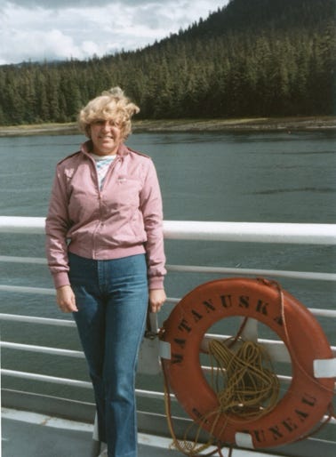
The M.V. Matanuska is at the dock ready for us to board to go to Skagway, Alaska.
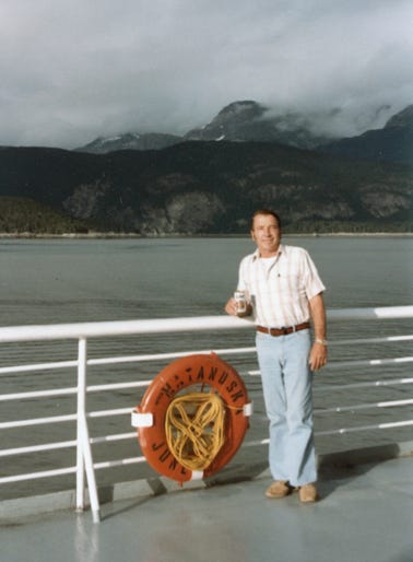
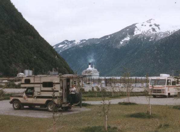
Bill was on the deck having a beer, even though it was cold, a beer still tasted really good. We are now heading up the Chilkoot Inlet to Skagway
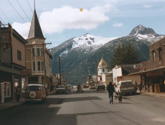
Skagway is named after the Indian word “Skagua,” meaning “windy place,” it once had a population of 40,000 gold seekers in the days of 1897 to 1898. The population of Skagway is around 800, and the annual rainfall is 26 inches a year.
We stayed at an RV park next to the ferry terminal and spent several days sightseeing the area.
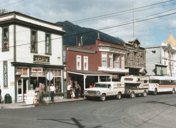
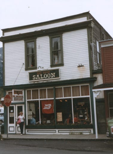
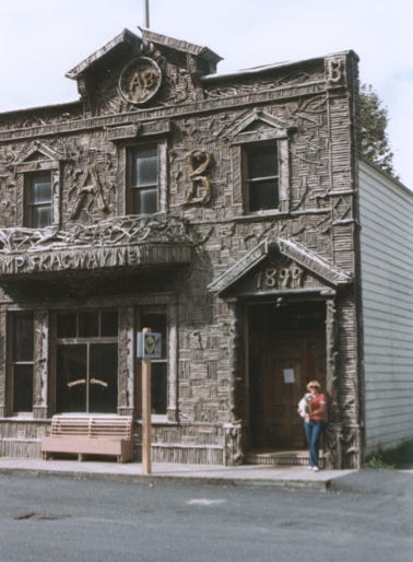
Downtown Skagway and a photo of the “Red Onion Saloon,” established in 1898. A photo of the 1899 “Arctic Brotherhood Hall,” is constructed of more than 20,000 small pieces of driftwood, very unique.
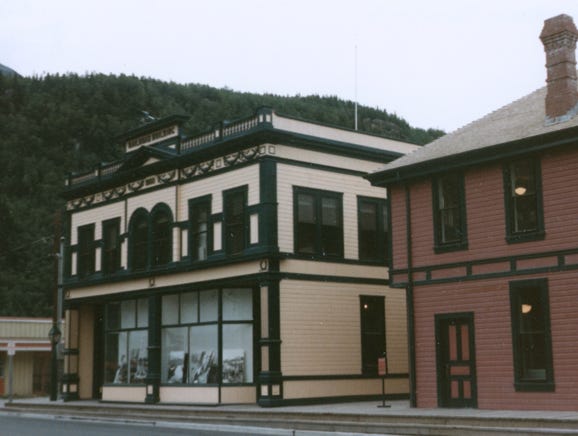
The White Pass & Yukon Route Broadway Depot is now the visitor’s center and headquarters but was the first building built by the railroad as construction began on the railroad in 1898. The building was restored from 1979-1984 to its 1908-1915 period for $1,600,000 which included the Administration Building next door.
Nancy is chatting with an 1898 gold miner.
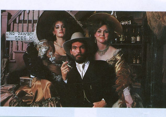
The “Days Of ’98,” pageant all helps recreate the days of Soapy Smith; the most notorious con man and criminal of the gold rush era who based his operations in Skagway.
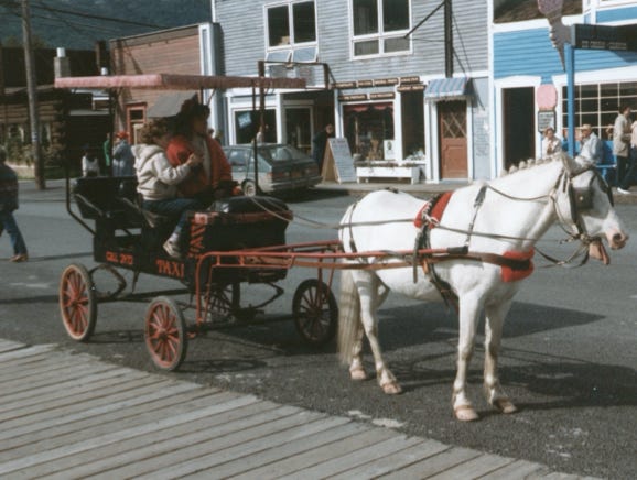
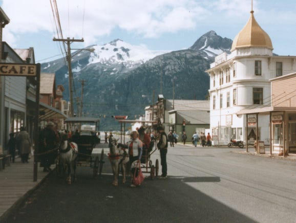
Another way to get around town is to take a horse-drawn taxi.
A view of downtown Skagway, the snow-capped mountains, and the Golden North Hotel, Alaska’s oldest operating hotel, built in 1897. It features original 1900’s furnishings.
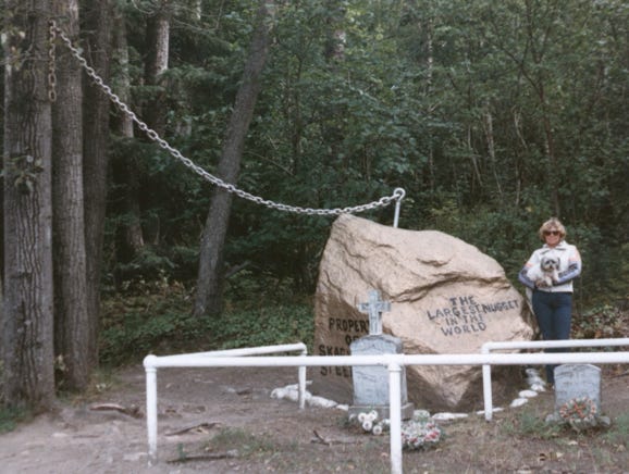
Nancy and Lady at the “Gold Rush Cemetery and the largest Gold Nugget in the World!”
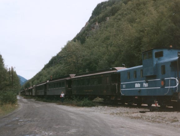
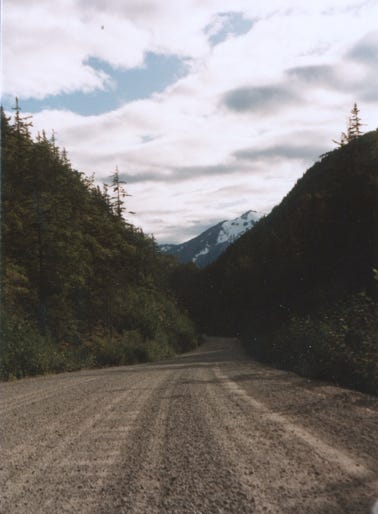
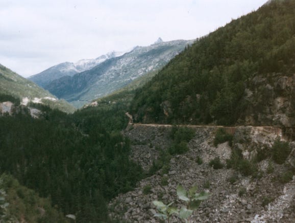
The next day we drove the Klondike Highway along the route of the White Pass and Yukon Railway, you will see the narrow gauge line that was built between 1898 and 1900 during the height of the Klondike Gold Rush. It winds along the original White Pass Trail of ’98, through some of the country’s most awesome scenery.
This is, of course, a dirt, and gravel road, something that we are familiar with since we drove the Alcan Highway years before. You can see by the photo on the East side of the canyon the remains of the old brackets wagon road below the track. This road was constructed in 1897 and served as a toll road from Skagway to White Pass City.
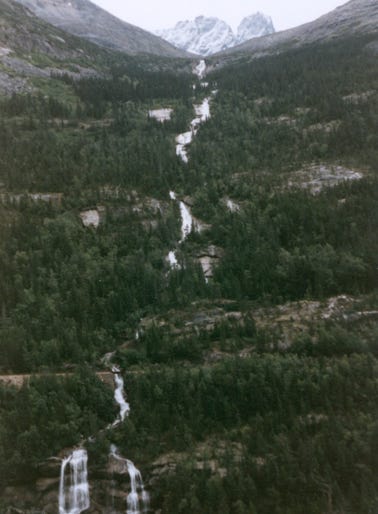
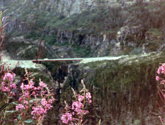
What a beautiful fall, this is called “Pitchfork Falls,” as it tumbles down the mountain from Goats Lake. Moose Creek Bridge spans a 110-foot wide gorge with Moose Creek at 180 feet below the span. At the time, it was built, the single-end support bridge was the only one of its kind in North America.
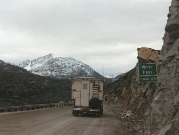
We finally reached the summit of the Klondike Highway, with an elevation of 3,290 feet above sea level.
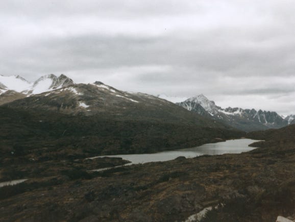
As we continued heading north on the highway, you will see Summit Lake and the snow-capped mountains.
Here, we are at the White Pass Yukon Route Border Station, and Summit Lake.
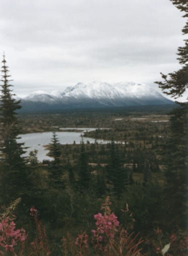

As we drove along the highway to Whitehorse we passed Bernard Lake and Tutshi Lakes. You can see in the photo the truck along the side of the Klondike Highway and the snow-covered mountains with some snow falling.
We did not drive all of the way to Whitehorse because we already explored the area on our previous trip to Alaska in 1978. We turned around and drove back to Skagway to prepare to board the M.V. Malaspina the next day to head south to Petersburg.

Leaving Skagway heading South to Petersburg we pass Meade Glacier.
We booked a stateroom for this route to Petersburg because it was a 10-hour trip, and we did not want to try to sleep in lounge chairs on the ship.
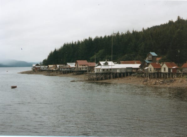
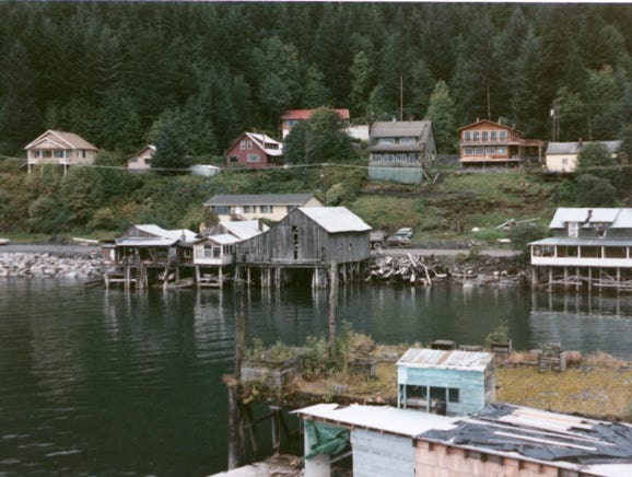
As we approached Petersburg, Alaska also known as “Little Norway,” located on Mitkof Island in the Wrangell Narrows. Petersburg has a Scandinavian heritage with traditional paintings on the houses and shops. This is the home port to the largest Halibut fleet in Alaska. The population is 3,000, and the annual rainfall is 105 inches a year!
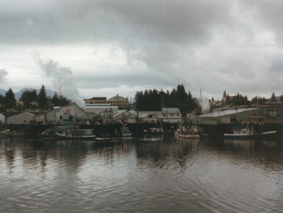
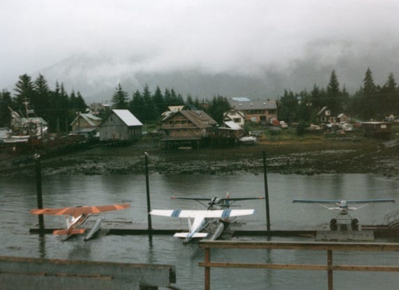

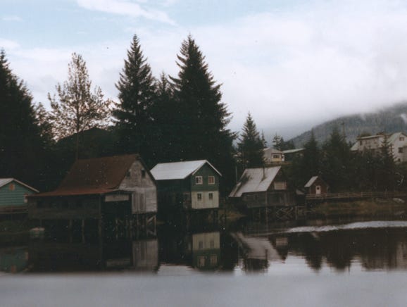
You will see the Halibut fleet and fish processing plants along the shoreline. A photo of seaplanes in “Hammer’s Slough.” This is the Son’s of Norway Hall at the entrance to “Hammer’s Slough” which was built by the community residents in 1912. The building has colorful Rosemal shutters.
Hammer’s Slough is a saltwater eddy lined with stilt houses and colorfully decorated shutters.
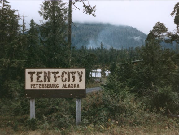
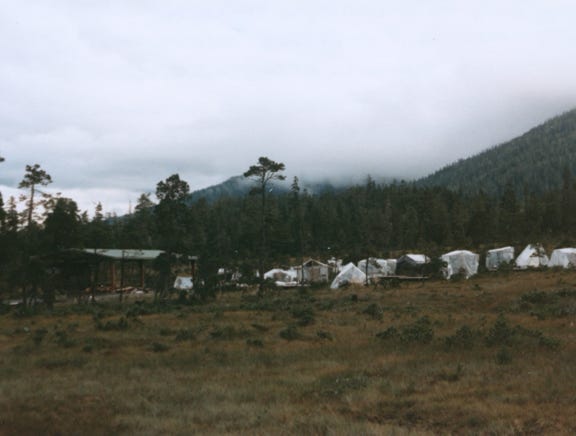
Here, we are at “Tent City,” a camping facility accommodating 150 people, primarily young summer cannery workers. Wooden tent platforms and boardwalks are provided to keep the campers off the muskeg. You can see many plastic tarps to protect the tents “underneath,” from all of the rain.
After exploring Petersburg, we arrive at the dock to board the M.V. Matanuska, as we are now approaching Wrangell Narrows you can see this 21-mile stretch between Mitkof and Kupreanof Islands (between Petersburg and Wrangell).
The Alaska state ferries and smaller cruise ships navigate the narrow channel, but the larger cruise ships do not. One ship goes through at a time while others wait outside in the open channel area.
The photo you will see is called “Christmas Tree Lane,” these are blinking red, white, and green navigational aids lighting the narrow Wrangell passage, and was given this nickname. This channel is only 300 feet wide and even less between the red and green buoys.
Nancy is on the deck of the M.V. Matanuska in the Wrangell Narrows. As we approach Wrangell, it is on Wrangell Island. Wrangell began as a fur trading post in 1834, and since that time has thrived under three different flags, Russian, English, and American. The population is 2,300 and the annual rainfall is 72 inches a year.
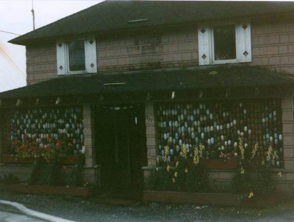
Photos of Wrangell and the waterfront area with homes on stilts. This was a unique home with fishnet floats as a decoration.
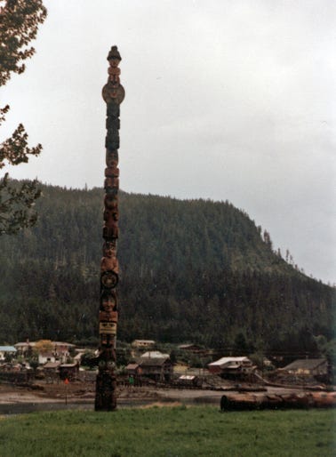
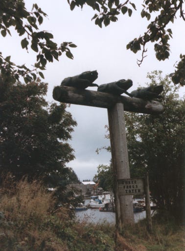
A large totem pole on Stakes Island.
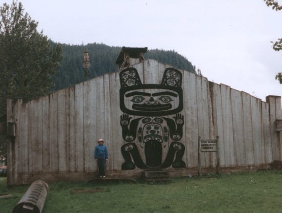
This is Chief Stakes Bear Tribal House, Chief Stake VII dedicated this house at the Great Potlatch in 1940. The interior house posts are more than 200 years old. A photo of three frogs totem on Stakes Island.
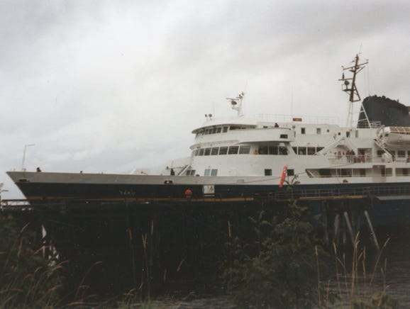
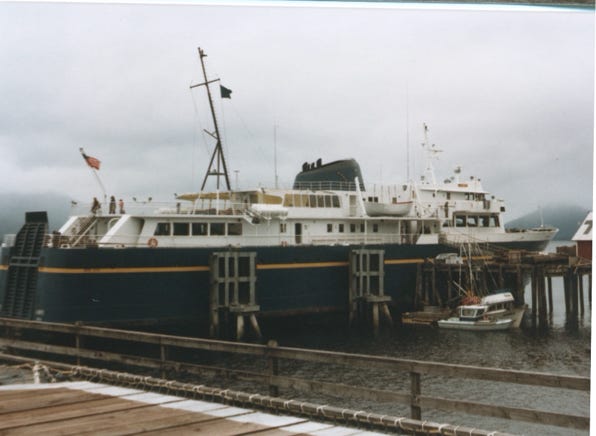
After exploring and getting Lady back on solid ground for a while, it was time to board another ship to continue going South. We boarded the M.V. Taku at Wrangell heading South to Ketchikan, Alaska. The length of this ship is 352 feet, and it carries 500 passengers and 105 vehicles.
We arrived at Ketchikan and spent several days sightseeing the area, Lady by now is getting a bit tired of being in the camper below deck, but she enjoys the stops we make when we can get off of the ship and spend several days at the new location.
Ketchikan is five miles long, four blocks wide, and two blocks up Deer Mountain, which describes this Southernmost Alaskan City located on Revillagigedo Island. The population of Ketchikan is 12,000.
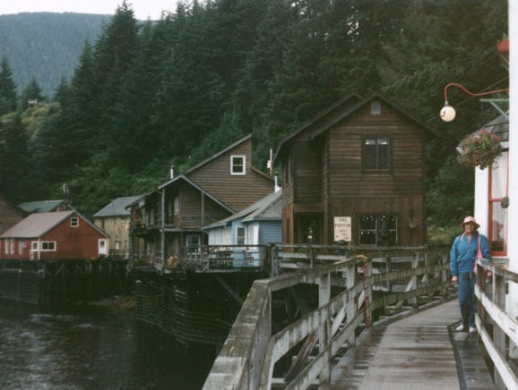
A photo of “Dolly’s House,” is found along the Creek Street Boardwalk, once a red light district, it is now shops and a business area. With an average annual rainfall of 160 inches a year, it makes it the wettest town on the North American Continent!
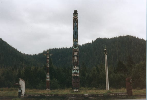
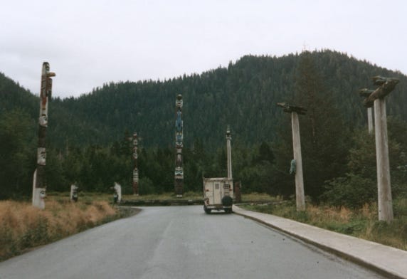
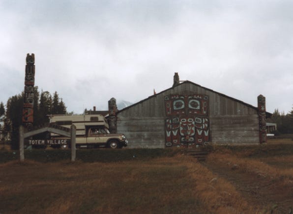
We drove to Saxman Totem Park which has 22 totems including Raven, The Sun, Giant Clam, and Lincoln built in 1830.
Ketchikan is also the home of the world’s largest collection of totem poles.
As we drove through the area we saw homes built on logs floating in “Ward’s Cove,” they do this so when the tide goes out or comes
in they can have access to their homes.
The logs last for 20 years before they need to be replaced.

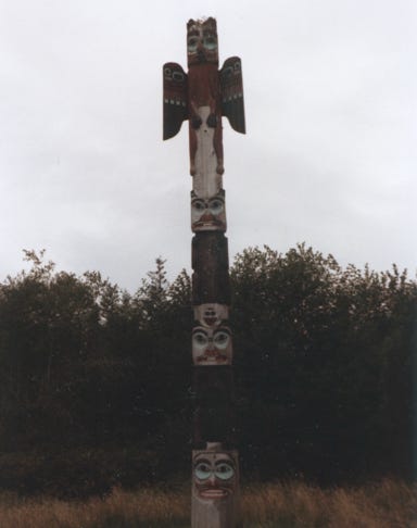
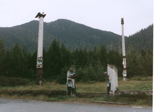
This is the Tlingit Community House at Totem Bight Park. This contains the largest collection of Tlingit and Haida poles in Southeast Alaska.
We walked the trail winding through the rain forest seeing many totems. On the shoreline from Totem Bight Park, with a photo and sunshine, yeah!
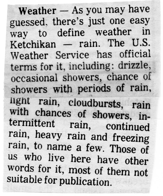
These are some interesting facts about Ketchikan, and what the locals say about their town. Read and enjoy.
Ketchikan, it only rains twice in Ketchikan, January through June, and July through December. If you are planning an outing and it’s raining, do it anyway, if you don’t, you may never get the chance if you wait for good weather!
If it’s raining and you see an umbrella, nine times out of ten, a visitor is underneath it. The locals are also easily identified, they’re the ones with moss behind their ears, webs on their feet, and life jackets on their bodies.
Ketchikan’s favorite leisure time activities are cutting wood, splitting wood, hauling wood, and stacking wood.
Ketchikan’s greatest claim to fame is horizontal rain which averages about 13 feet a year. Much of it arrives in great deluges, pushed sideways by 60 mph winds.
Ketchikan Sneakers, also known as Wrangell tennis shoes or Southeastern sandals. These are the famous red rubber boots that reach at least three-quarters of the way up the lower leg. Whether attending a wedding, church service, or traveling, many people consider them “de rigueur.”
The above funny comments were picked up in their local paper, and just had to add them to our story.
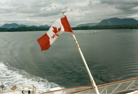
Our Inside Passage trip is coming to an end, and we boarded the M.V. Queen of the North and were heading South to Port Hardy, B. C.
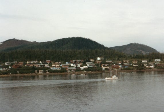
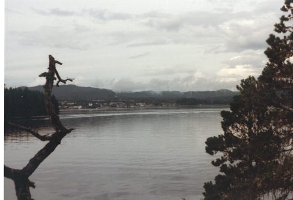
We passed the coastal town of Bella Bella on the Seaforth Channel in Canada.
Nancy on the deck of M.V. Queen of the North.
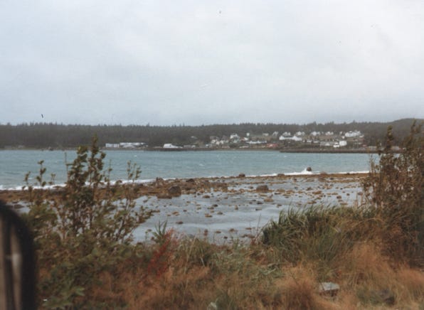
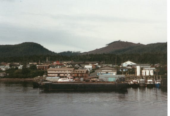
Arriving at Port Hardy and the town in the background.
This trip takes many months of planning, you need to get the ferry schedules from Alaska and Canada and see all of the ports that they stop at, then figure out how many days you want to be at each port to explore the area. Sometimes we only had a day because of the ferry schedule where the ferry stopped at the port once every three days, or once a week and we did not want to stay at one place that long. We picked the most important places that we wanted to see, and we had a great time.
While it was sometimes hard on Lady having to be on the lower deck, we saw many other people with their dogs and cats traveling the way we did. We are glad that we had the truck and camper because it was easy to load on and off of the ferries and drive around the island that we explored.
While a cruise ship is a more luxurious way to travel, you won’t be able to spend much time seeing the quaint towns, and totem poles, and walk around the area.